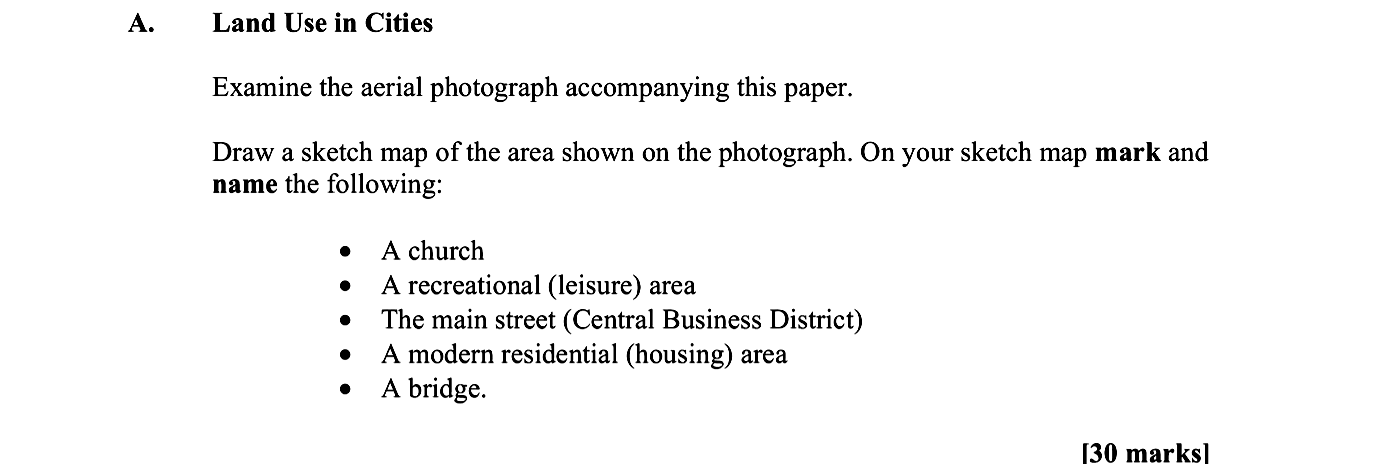
Examine the aerial photograph accompanying this paper - Leaving Cert Geography - Question A - 2010
Question A
Examine the aerial photograph accompanying this paper.
Draw a sketch map of the area shown on the photograph. On your sketch map mark and name the following:
- A c... show full transcript
Worked Solution & Example Answer:Examine the aerial photograph accompanying this paper - Leaving Cert Geography - Question A - 2010
Step 1
Draw a sketch map
96%
114 rated
Only available for registered users.
Sign up now to view full answer, or log in if you already have an account!
Answer
Begin by outlining the limits or frame of your sketch map. Ensure that the proportions are accurate, reflecting the landscape in the aerial photograph. Consider the overall impression of the area to provide a clear representation.
Step 2
A church
99%
104 rated
Only available for registered users.
Sign up now to view full answer, or log in if you already have an account!
Answer
Identify a prominent location on your sketch map to mark the church. Clearly label it as 'Church' to meet the naming requirement.
Step 3
A recreational (leisure) area
96%
101 rated
Only available for registered users.
Sign up now to view full answer, or log in if you already have an account!
Answer
Designate an area that represents recreational or leisure activities. Label this section 'Recreational Area' to ensure clarity.
Step 4
The main street (Central Business District)
98%
120 rated
Only available for registered users.
Sign up now to view full answer, or log in if you already have an account!
Answer
Illustrate the main street, often considered the Central Business District (CBD). Clearly mark and label this section as 'Main Street (CBD)' to avoid any confusion.
Step 5
A modern residential (housing) area
97%
117 rated
Only available for registered users.
Sign up now to view full answer, or log in if you already have an account!
Answer
Define a part of your map that signifies modern residential housing. Label this area as 'Modern Residential Area' to specify its function.
Step 6
A bridge
97%
121 rated
Only available for registered users.
Sign up now to view full answer, or log in if you already have an account!
Answer
Include and label a bridge in your sketch map, ensuring it is clearly marked as 'Bridge' to meet the identification criteria.
Join the Leaving Cert students using SimpleStudy...