Photo AI
Examine this diagram, which refers to Christaller’s Central Place Theory - Leaving Cert Geography - Question 30 - 2008
Question 30
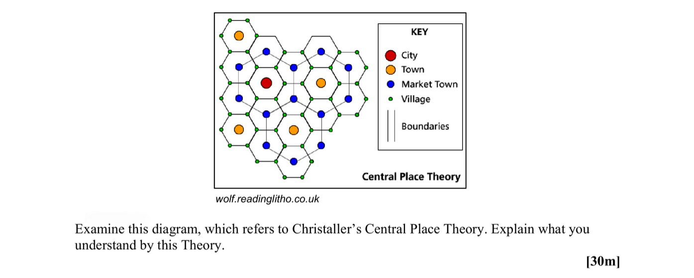
Examine this diagram, which refers to Christaller’s Central Place Theory. Explain what you understand by this Theory.
Worked Solution & Example Answer:Examine this diagram, which refers to Christaller’s Central Place Theory - Leaving Cert Geography - Question 30 - 2008
Step 1
Understanding Central Place Theory

Answer
Central Place Theory, formulated by Walter Christaller in 1933, seeks to explain the size, number, and distribution of human settlements in a hierarchical manner. It emphasizes the role of central places, which are urban centers providing services to the surrounding area, thus supporting the economic function of these settlements.
The theory is based on several key concepts including:
-
Central Places: These are settlements that offer goods and services to the population. Their size and number depend upon their functions and the distance people are willing to travel to access these services.
-
Hierarchy of Places: Settlements are arranged in a hierarchy from small villages to large cities, where smaller places serve a limited range of functions and larger places provide higher-order services.
-
K-values: Depending on the market area, Christaller identified different patterns of distribution based on the K-value, which is the ratio of higher-order settlements to lower-order ones. For instance, a K-value of 3 indicates that each higher-order settlement serves three lower-order settlements.
Step 2
Analyzing the Diagram
Answer
The provided diagram illustrates various types of settlements as per the Central Place Theory, represented by different colors and symbols including:
- Red circles (Cities): These represent large central places that offer a wide range of services and attract residents from broader areas.
- Orange circles (Towns): These provide intermediate services and act as central places for smaller settlements.
- Yellow circles (Market Towns) and Green circles (Villages): Indicate lower-order settlements that offer basic services and cater primarily to local populations.
The hexagonal pattern signifies market areas where the central places seek to optimize their reach. This model shows the efficiency of land use and highlights how spatial distribution of these places leads to economic viability.
Step 3
Real-World Examples
Answer
Examples of Central Place Theory can be observed in various regions. For instance, in rural areas, small villages may serve as basic service points (like grocery stores), while towns nearby serve more elaborate needs such as healthcare. As one moves to larger cities, the concentration of higher-order services can be noted, highlighting the varying levels of economic activity and accessibility.