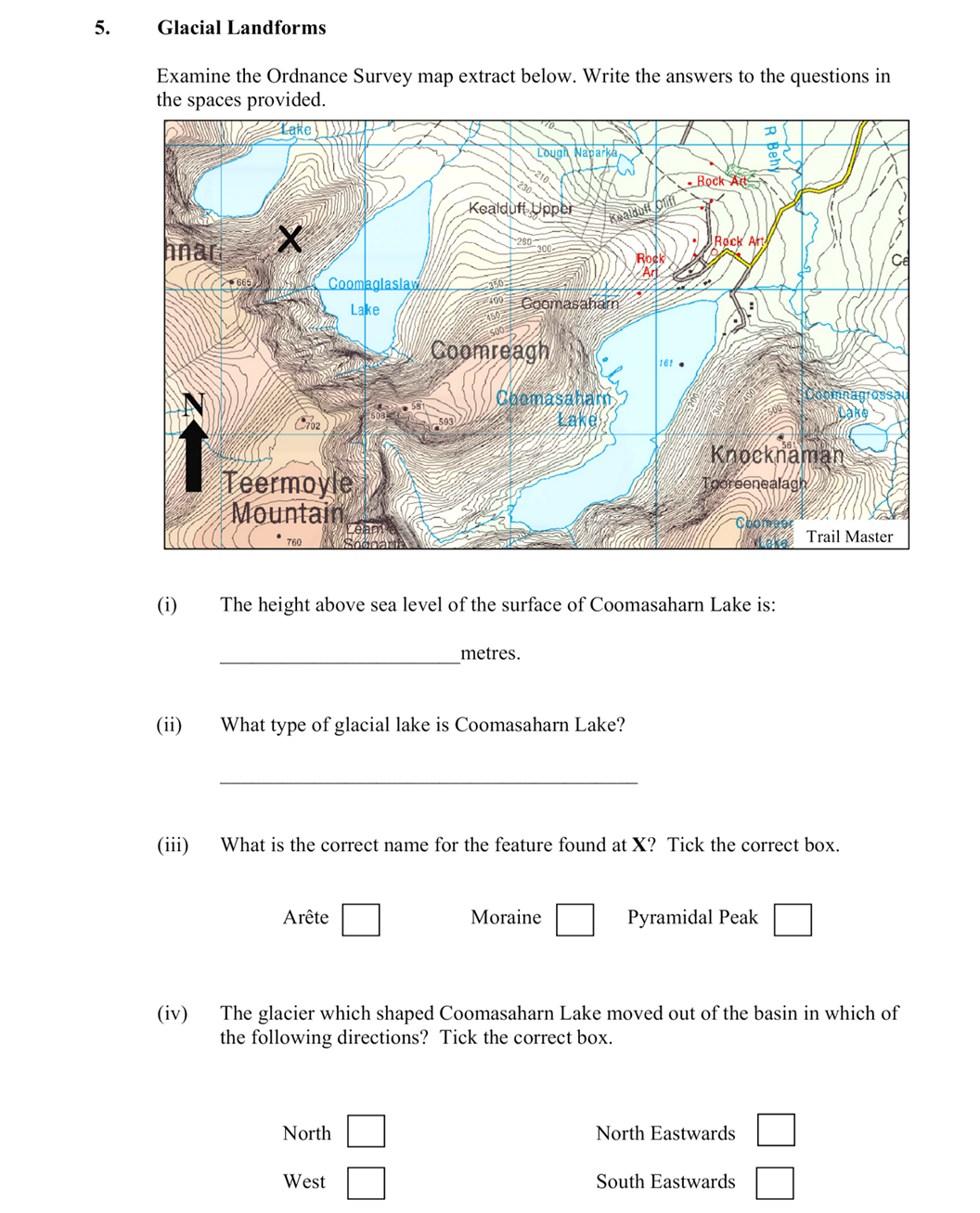
Examine the Ordnance Survey map extract below. Write the answers to the questions in the spaces provided.
(i) The height above sea level of the surface of Coomasaha... show full transcript
Worked Solution & Example Answer:Examine the Ordnance Survey map extract below - Leaving Cert Geography - Question 5 - 2010
Step 1
The height above sea level of the surface of Coomasaham Lake is:
96%
114 rated
Only available for registered users.
Sign up now to view full answer, or log in if you already have an account!
Answer
161 metres.
Step 2
What type of glacial lake is Coomasaham Lake?
99%
104 rated
Only available for registered users.
Sign up now to view full answer, or log in if you already have an account!
Answer
Crique/Corrie/Tarn/Coom/Ribbon.
Step 3
What is the correct name for the feature found at X? Tick the correct box.
96%
101 rated
Only available for registered users.
Sign up now to view full answer, or log in if you already have an account!
Answer
Arête.
Step 4
The glacier which shaped Coomasaham Lake moved out of the basin in which of the following directions? Tick the correct box.
98%
120 rated
Only available for registered users.
Sign up now to view full answer, or log in if you already have an account!
Answer
North Eastwards.
Join the Leaving Cert students using SimpleStudy...