Photo AI
Last Updated Sep 27, 2025
Relief on OS Maps Simplified Revision Notes for Leaving Cert Geography
Revision notes with simplified explanations to understand Relief on OS Maps quickly and effectively.
248+ students studying
Relief on OS Maps
How Relief is Represented on OS Maps
Contour Lines
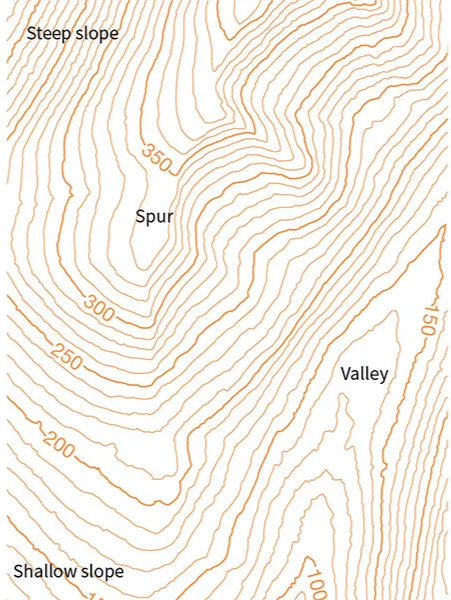
- Definition: Thin brown lines that join points of equal elevation above sea level.
- Interval: On 1:50,000 OS maps, the contour interval is typically 10 meters.
- Key Characteristics:
- Closely spaced contours = steep slopes.
- Widely spaced contours = gentle slopes.
- Circular contours indicate hills or mountains.
Spot Heights
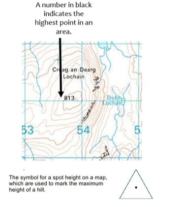
- Definition: Exact elevation at a specific point, marked with a dot and a number (e.g., 350 m).
- Used to identify high points, such as summits.
Triangulation Pillars
- Represented by a small triangle with a spot height.
- Found at prominent hill or mountain peaks, used for surveying.
Shading
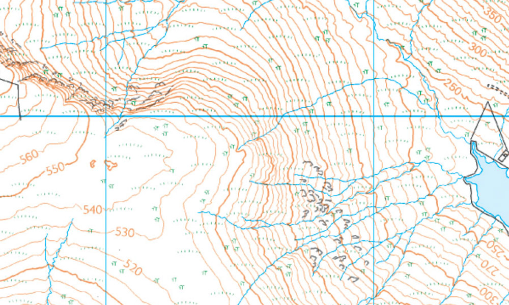
- Some maps use hill shading to indicate relief visually by simulating light and shadow.
Colouring
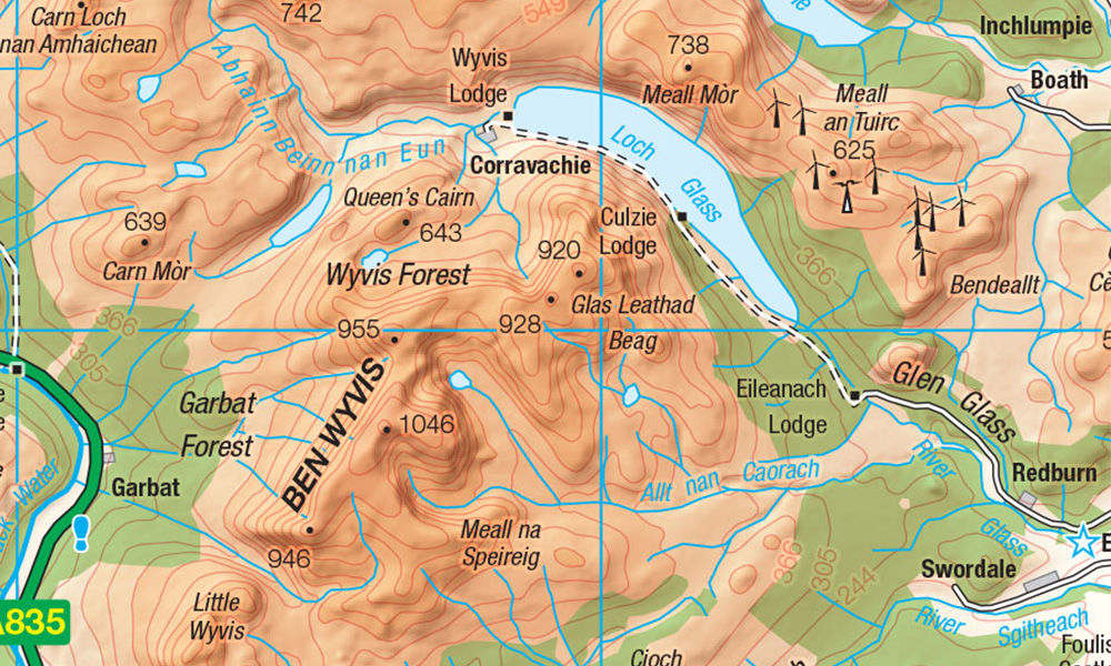
- Often used to show elevation ranges:
- Dark green = lowland.
- Light green/yellow = mid-elevation.
- Brown = highland.
Interpreting Relief Features
Hills and Mountains
- Circular or oval contour patterns with increasing elevation toward the center.
Valleys
- Contours form a "V" shape pointing upstream.
- Rivers or streams usually flow through the bottom of the valley.
Ridges
- Contours form long, narrow, elevated areas.
Plateaus
- Contours are widely spaced with few changes in elevation over a large area.
Cliffs
- Contours are extremely close together, often merging, indicating vertical or near-vertical slopes.
Applications of Relief in Geography
Understanding Landforms
- Identify features such as hills, valleys, and plains.
Land Use and Settlement
- Analyze how relief influences activities like farming, forestry, and settlement patterns.
- Example: Flat areas are better suited for agriculture, while steep slopes are less accessible.
Navigation
- Plan routes based on terrain difficulty, avoiding steep slopes or following valleys.
Key Tips for Interpreting Relief
- Always check the contour interval on the map's legend.
- Use spot heights and triangulation pillars for precise elevation data.
- Follow the "V" rule for valleys: the "V" points upstream.

500K+ Students Use These Powerful Tools to Master Relief on OS Maps For their Leaving Cert Exams.
Enhance your understanding with flashcards, quizzes, and exams—designed to help you grasp key concepts, reinforce learning, and master any topic with confidence!
226 flashcards
Flashcards on Relief on OS Maps
Revise key concepts with interactive flashcards.
Try Geography Flashcards24 quizzes
Quizzes on Relief on OS Maps
Test your knowledge with fun and engaging quizzes.
Try Geography Quizzes29 questions
Exam questions on Relief on OS Maps
Boost your confidence with real exam questions.
Try Geography Questions27 exams created
Exam Builder on Relief on OS Maps
Create custom exams across topics for better practice!
Try Geography exam builder47 papers
Past Papers on Relief on OS Maps
Practice past papers to reinforce exam experience.
Try Geography Past PapersOther Revision Notes related to Relief on OS Maps you should explore
Discover More Revision Notes Related to Relief on OS Maps to Deepen Your Understanding and Improve Your Mastery
96%
114 rated
Ordnance Survey Maps
Drawing Skills: Sketch Maps and Cross-Sections
410+ studying
190KViews