Human activity and OS maps (Edexcel GCSE Geography A): Revision Notes
Human activity and OS maps
Understanding human activity on Ordnance Survey maps
When studying geography, you'll need to develop skills in reading and interpreting OS maps to identify different types of human activity. These maps contain valuable information about how people use the land, and you may be tested on your ability to recognise and locate various forms of human activity using map evidence.
OS maps display clear visual clues that help geographers understand the relationship between people and their environment. Learning to spot these clues and provide precise locations using grid references is an essential skill for your geography studies.
Types of human activity shown on OS maps
OS maps reveal three main categories of human land use, each with distinct characteristics that you can learn to identify.
Three Main Types of Human Land Use on OS Maps:
- Industrial land use - factories, manufacturing, and production areas
- Residential land use - houses, flats, and where people live
- Rural land use - countryside, farming, and forestry activities
Each type has distinct visual characteristics and map symbols that help you identify them quickly.
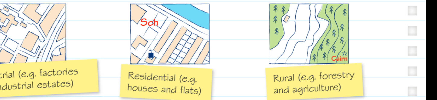
Industrial land use
Industrial areas on OS maps typically show evidence of economic activity focused on manufacturing and production. These zones contain factories, industrial estates, and related infrastructure. You'll often see these areas marked with specific symbols and connected to major transport routes like railways and main roads. Industrial zones usually appear more densely packed with buildings and have fewer green spaces compared to other land uses.
Residential land use
Residential areas represent where people live and make their homes. On OS maps, these zones show concentrations of houses and flats, often arranged in street patterns. You might notice different housing densities - some areas show closely packed terraced housing while others display more spread-out suburban developments. Residential areas typically include local amenities like schools, shops, and parks that serve the community's daily needs.
Rural land use
Rural areas encompass countryside activities and natural landscapes. These zones show evidence of agriculture, forestry, and other land uses that work with the natural environment. On maps, you'll see features like field boundaries, woodland symbols, farm buildings, and scattered settlements. Rural areas generally have much lower population densities and more open space between human developments.
Identifying evidence of human activity
Using grid references for precise location
When answering geography questions about OS maps, you must provide specific grid references to show exactly where you've found evidence of human activity. Grid references use a numerical system that allows you to pinpoint locations accurately on the map.
Critical Exam Technique: Always include precise grid references when identifying map evidence. This demonstrates your map reading skills and helps examiners verify your answers. Remember to give six-figure grid references when possible, as these provide the most accurate locations.
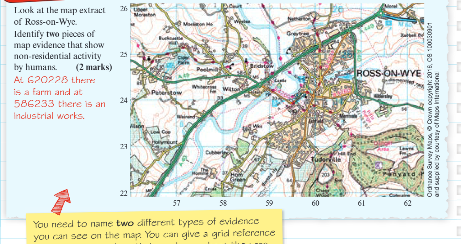
Worked Example: Identifying Non-Residential Human Activity
Using the OS map extract of Ross-on-Wye:
Step 1: Locate evidence of non-residential activity
- At grid reference 620228: Evidence of farming activity (agricultural land use)
- At grid reference 586233: Industrial works (manufacturing activity)
Step 2: Explain why these are good examples These examples show two different types of economic activity that aren't related to housing - one agricultural, one industrial.
This demonstrates the variety of non-residential human activities visible on OS maps.
Recognising different types of evidence
When examining OS maps for human activity, you need to distinguish between residential and non-residential activities. Non-residential activities include economic functions like farming, manufacturing, retail, and community services. These activities often have specific symbols or visual characteristics that make them identifiable on the map.
Avoid Common Mistakes: When questions ask for two different types of evidence, avoid similar examples. Don't list two different types of shops or two different industrial activities when the question asks for variety. Always provide contrasting examples to demonstrate your understanding.
Successful map reading requires you to provide two different types of evidence when asked. This means avoiding similar examples - for instance, don't list two different types of shops or two different industrial activities when the question asks for variety.
Practical application with community facilities
Understanding human activity extends beyond basic land use categories to include community facilities and services. These features serve local populations and contribute to the social geography of an area.
When completing tasks involving facility identification, you'll need to recognise both the facility name and its corresponding map symbol. For example, car parks use a specific symbol that appears consistently across OS maps. Developing familiarity with common map symbols helps you quickly identify various community facilities and services.
Community Facility Patterns: Community facilities often cluster together in town centres or suburban areas, reflecting how people organise their daily activities and services. Understanding these patterns helps you interpret the social and economic geography of different places.
Community facilities often cluster together in town centres or suburban areas, reflecting how people organise their daily activities and services. Understanding these patterns helps you interpret the social and economic geography of different places.
Key Points to Remember:
- OS maps show three main types of human activity: industrial (factories and manufacturing), residential (houses and flats), and rural (farming and forestry)
- Always provide precise grid references when identifying map evidence - this shows your map reading skills
- Look for two different types of evidence when questions ask for variety - avoid choosing similar examples
- Non-residential activities include farming, industry, shops, and community facilities - these are different from housing
- Practice recognising map symbols for different facilities, as these appear consistently across different OS maps