Fluvial Landforms - Caused by Deposition (OCR GCSE Geography A (Geographical Themes)): Revision Notes
📚 Revision Notes
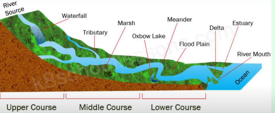
3.3.3 Fluvial Landforms - Caused by Deposition
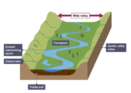
Floodplains
Note
Floodplain: The area of land next to a river, which can flood.
- During a flood:
- Material carried by the river is deposited as the river loses speed and energy.
- Height of the floodplain increases over time as material is deposited on either side of the river.
- Agricultural Land:
- Floodplains are often used for agriculture as the area is very fertile.
- Fertility comes from alluvium (deposited silt from a river flood).
Estuary
- Where the river meets the sea.
- The river here is tidal; when the sea retreats, the volume of water in the estuary is reduced.
- When there is less water, the river deposits silt to form mudflats, which are important habitats for wildlife.
- The land of an estuary is not very fertile, making it unsuitable for agriculture.
- Estuaries create good habitats for wildlife.
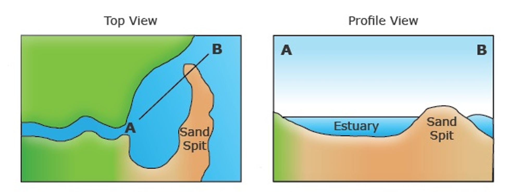
Estuary
Delta
- Found at the mouth of large rivers (e.g., the Mississippi).
- Formed when the river deposits material faster than the sea can remove it.
- As the river approaches the sea, it loses energy and deposits material.
- Sediment may be sorted, with the heaviest material deposited first.
- Over time, more sediment is added, building up a land mass (delta) at the mouth of the river.
- Strong tides can wash away sediment; if not, it will accumulate to form a delta.
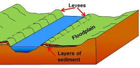
Levees
-
Natural embankments along the edges of a river.
-
During a flood, eroded material is deposited over the whole floodplain.
-
Heaviest material is deposited closest to the river channel as the river slows down.
-
Over time, deposited material builds up, creating levees along the edges of the channel.