Study the sketch map showing some functional zones within a city - Junior Cycle Geography - Question Question 1 - 2006
Question Question 1
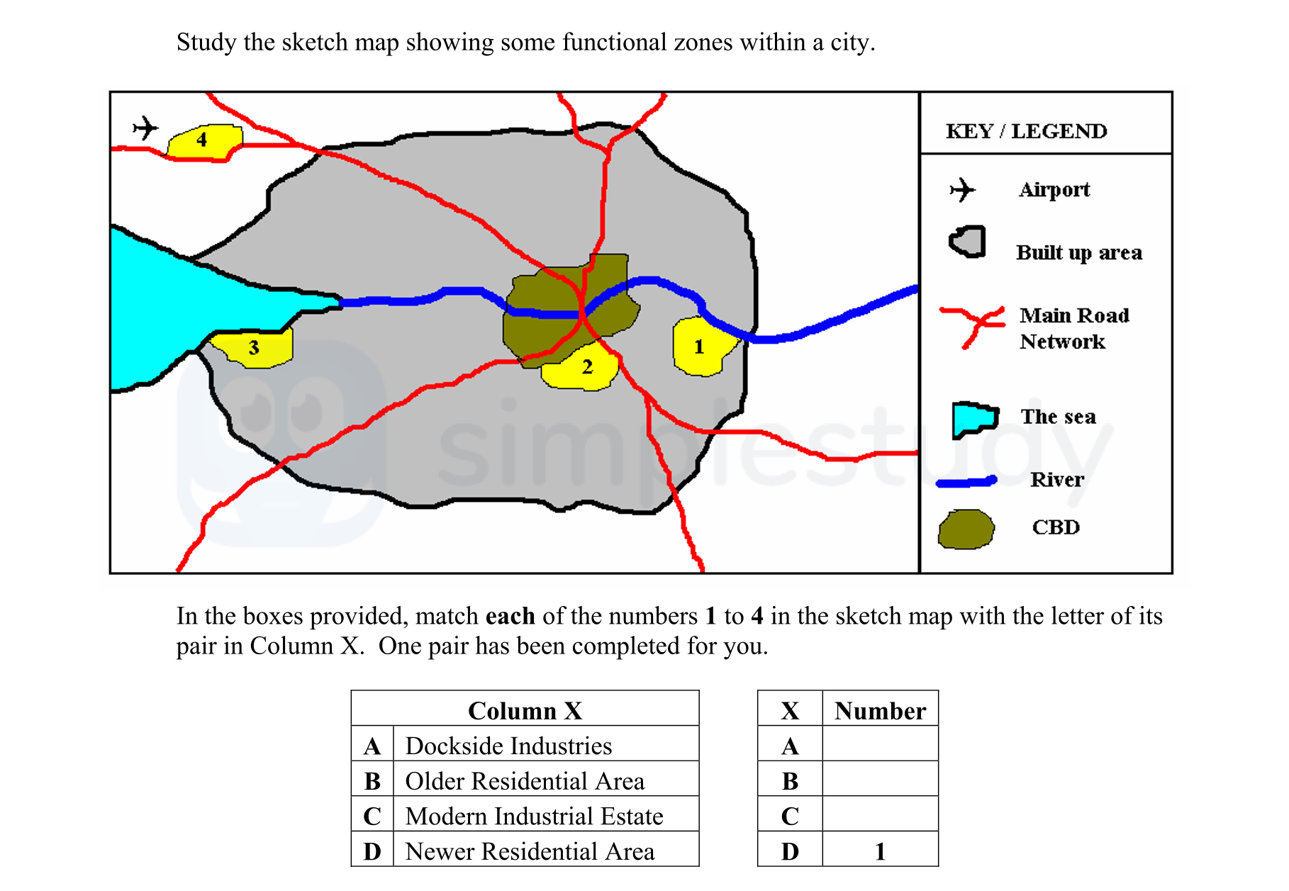
Study the sketch map showing some functional zones within a city.
In the boxes provided, match each of the numbers 1 to 4 in the sketch map with the letter of its p... show full transcript
Worked Solution & Example Answer:Study the sketch map showing some functional zones within a city - Junior Cycle Geography - Question Question 1 - 2006
Step 1
A Dockside Industries
96%
114 rated
Only available for registered users.
Sign up now to view full answer, or log in if you already have an account!
Answer
The zone marked with number 3 in the sketch map corresponds to 'Dockside Industries'. This is typically located close to transportation routes, such as the river, to facilitate the movement of goods.
Step 2
B Older Residential Area
99%
104 rated
Only available for registered users.
Sign up now to view full answer, or log in if you already have an account!
Answer
The area marked as number 2 represents the 'Older Residential Area'. This is often found near the city center where historical properties and earlier developments are located.
Step 3
C Modern Industrial Estate
96%
101 rated
Only available for registered users.
Sign up now to view full answer, or log in if you already have an account!
Answer
The zone labeled as number 4 corresponds to the 'Modern Industrial Estate'. Generally, this type of area is positioned further from the CBD, indicating newer developments catering to industrial needs.
Step 4
D Newer Residential Area
98%
120 rated
Only available for registered users.
Sign up now to view full answer, or log in if you already have an account!
Answer
Finally, the number 1 area refers to 'Newer Residential Area'. It is typically established on the outskirts of the city, reflecting contemporary housing trends designed for growth.
Join the Junior Cycle students using SimpleStudy...