Photographs of Landscapes (Grade 10 NSC Matric Geography): Revision Notes
Photographs of Landscapes
Introduction to landscape photography in geography
Photographs serve as powerful geographical tools that help us explore and understand our world. They transport us to distant locations, allowing us to study different landforms and environments that we might never visit in person. Through photographs, we can examine landscapes from unique viewpoints and gain fresh perspectives on how our planet's features are formed and interact with each other.
Photographs are particularly valuable in geography because they allow us to be transported to different places on our planet, to visualise and study landforms that do not necessarily occur in our environment, and to view objects from a different perspective.
When studying landscape photographs, we develop important skills in visual analysis that are essential for geographical understanding. These images capture both the physical features of our environment and the human activities that shape the landscape around us.
Essential questions for photograph analysis
To properly interpret landscape photographs, geographers ask themselves several key questions that help unlock the story each image tells:
Key Analysis Framework
Master these essential questions to unlock the geographical story in every landscape photograph:
What type of features are shown?
- Natural features: Look for mountains, rivers, valleys, rock formations, vegetation, or coastal elements
- Human-made features: Identify buildings, roads, agricultural areas, industrial structures, or settlements
What does the photograph reveal?
- Places: Specific locations with unique characteristics
- Relief features: Mountain ranges, valleys, plains, or coastal formations
- Processes: Evidence of erosion, weathering, human impact, or natural changes over time
What is the photographic perspective?
- Distance: Determine if this is a close-up shot showing detail, or a distant shot showing broader patterns
- Camera angle: Notice whether the camera was held horizontally for a balanced view, or tilted for dramatic effect
- Viewpoint: Consider whether the photo was taken from ground level, an elevated position, or aerial view
How are elements arranged?
- Foreground: What objects or features appear closest to the camera?
- Background: What landscape elements extend into the distance?
- Depth: How does the photographer create a sense of three-dimensional space?
Examples of South African landscapes
South Africa's diverse geography provides excellent examples of different landscape types that can be studied through photography:
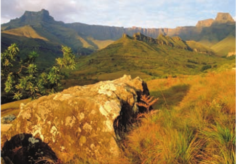
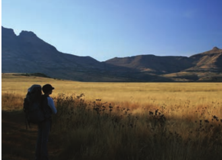
Mountain landscapes
The Drakensberg Mountains showcase dramatic escarpment features with steep cliffs and layered rock formations. These photographs often capture the contrast between rugged highlands and gentler slopes.
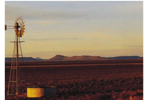
Arid environments
The Karoo landscape demonstrates how photography can reveal the characteristics of semi-desert regions, including sparse vegetation, wide open spaces, and evidence of water management like windmills.
Landscape Analysis: Karoo Semi-Desert
When examining Karoo photographs, look for:
- Sparse, drought-resistant vegetation patterns
- Wide, open horizons showing scale
- Human adaptations like windmills for water extraction
- Evidence of seasonal water flow in dry riverbeds
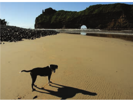
Coastal features
Eastern Cape coastal photographs, such as the famous "Hole in the Wall" formation, show how wave action creates unique rock arches and demonstrates ongoing coastal erosion processes.
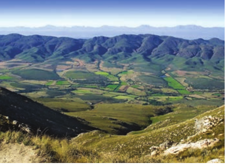
Agricultural valleys
Aerial views of farming areas reveal the geometric patterns created by human agricultural activity and show how people adapt to and modify natural landscapes for food production.
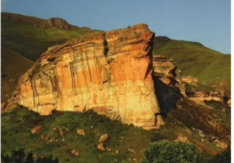
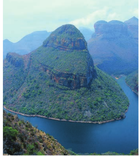
Rock formations
Distinctive geological features like Golden Gate's sandstone cliffs illustrate how different rock types weather and erode to create spectacular landscape forms.
Plains and plateaus
Photographs of areas like the Free State plains demonstrate how vast, relatively flat landscapes can be effectively captured to show scale and the relationship between land and sky.
Developing visual analysis skills
When examining landscape photographs, successful geographical analysis requires systematic observation. Start by identifying the most prominent features, then work outward to notice smaller details. Consider the lighting conditions, as these can dramatically affect how landscape features appear and what information the photograph reveals.
Building Your Analysis Skills
Visual analysis skills improve with practice. The more systematically you approach photograph interpretation, the more geographical information you'll be able to extract from each image.
Pay attention to scale indicators within the image - objects like people, vehicles, or buildings help us understand the true size of natural features. Vegetation patterns can provide clues about climate, while human modifications tell us about land use and settlement patterns.
The combination of natural and human elements in landscape photographs often reveals important geographical relationships, such as how people adapt to challenging environments or how human activities impact natural systems.
Key Points to Remember:
-
Photographs are valuable geographical tools that allow us to study landscapes we cannot visit in person and see familiar places from new perspectives
-
Ask systematic questions about natural vs human features, places vs processes, camera angles, and foreground-background relationships when analysing any landscape photograph
-
South African landscapes offer diverse examples including mountains, deserts, coasts, agricultural areas, and unique rock formations that demonstrate different geographical processes
-
Visual analysis skills develop with practice - the more photographs you study systematically, the better you become at reading the geographical story each image tells
-
Scale and perspective matter - understanding whether a photo shows close-up detail or broad patterns helps determine what geographical information it can provide