Understanding Population Distribution and Density (Grade 10 NSC Matric Geography): Revision Notes
Understanding Population Distribution and Density
Population geography helps us understand where people live and how crowded different places are around the world. This topic introduces two fundamental concepts that geographers use to study human settlement patterns.
What is population distribution?
Population distribution refers to how people are spread out over an area. When we look at a map showing where people live, we can see that some places have many people whilst others have very few. Geographers use dots on maps to show where certain numbers of people are located, creating clear visual patterns.
Population distribution maps are one of the most effective tools geographers use to visualise human settlement patterns across different scales — from local communities to provincial, national, and global populations.
Population distribution patterns
There are three main ways that populations can be distributed across regions. Understanding these patterns helps us analyse why people choose to live in certain areas.
Dispersed (sparse) pattern
In a dispersed pattern, people are scattered with large gaps between them and no clear arrangement. Settlements are few and far between, and population density is low. This often occurs in rural farming areas, deserts, and mountainous regions where the land cannot support large numbers of people.
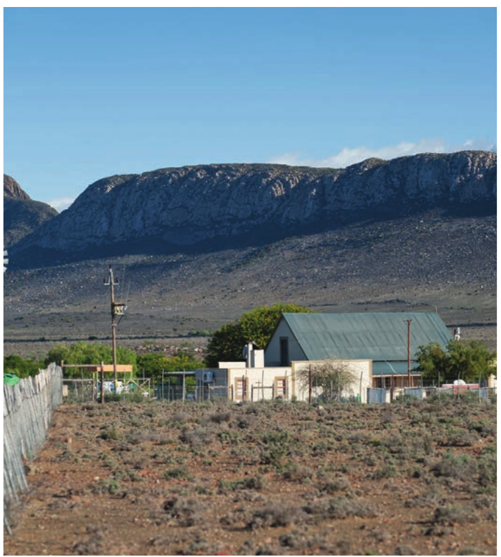
A South African example is the Karoo and parts of the Northern Cape, where individual farms and small towns are spread across vast, dry landscapes.
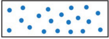
Dispersed patterns are commonly found in areas where the physical environment limits how many people the land can support — such as dry regions, mountainous areas, or places with poor soils.
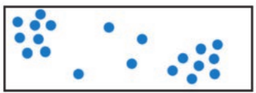
Clustered (dense) pattern
A clustered pattern shows people grouped closely together in one part of a region, leaving other areas mostly empty. This commonly happens around cities, mining areas, or places with good resources like fertile soils and reliable water sources.
In South Africa, Gauteng is the clearest example — it is the smallest province by area but home to the largest population, with people clustered around Johannesburg, Pretoria, and the surrounding mining and industrial areas.
Linear pattern
In a linear pattern, people arrange their settlements along a line. This frequently occurs along transport routes like rivers, roads, or railway lines, or along coastlines where people benefit from easy access to transportation and trade.
South African examples include settlements along the Orange River, the N1 highway corridor, and the KwaZulu-Natal coastline from Durban southwards.
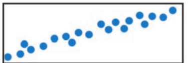
Linear patterns develop because people naturally settle where they have the best access to transportation, water, trade, and resources — which often follow natural or human-made linear features.
What is population density?
Population density measures how many people live in a square kilometre (1 km²). This helps us understand how crowded different places are by giving us specific numbers rather than just visual impressions.
Areas with many people packed into each square kilometre have a dense population. Areas with few people spread across each square kilometre have a sparse population.
Population density gives us a more accurate understanding of crowding than total population alone. A region might have many people but still not be crowded if it covers a very large area.
Calculating population density
To find the population density of any region, you use this simple formula:
Worked Example: Calculating Population Density
If a region has an area of 100 km² and 1,000 people live there:
Population Density = people per square kilometre
Important points to remember
- Always give the numerical value (10 in this example)
- Always include the unit of measurement (people per square kilometre or people/km²)
- The calculation tells us how many people would live in each square kilometre if they were spread evenly
Comparing dense and sparse populations
Real-world examples help us understand the dramatic differences in population density around the globe and within South Africa.
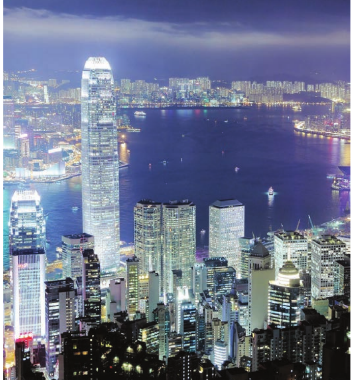
Densely populated areas like Gauteng in South Africa or major world cities such as Hong Kong, Mumbai, and Tokyo show large numbers of people living within small areas, creating extremely high population densities.
Sparsely populated areas like the Karoo and Northern Cape in South Africa — or world regions such as the Sahara Desert, the Amazon rainforest, Siberia, and the Australian outback — show very few people spread across vast landscapes, creating very low population densities.
Population density comparison
| Region | Area in km² | Population | Density (people/km²) |
|---|---|---|---|
| X | 1,000 | 25,000 | 25 |
| Y | 10,000 | 50,000 | 5 |
This table demonstrates that Region X has a much higher population density (25 people/km²) than Region Y (5 people/km²), even though Region Y has more total people. This shows why we need density measurements — they tell us about crowding, not just total population size.
Factors affecting population distribution and density
Several factors influence where people choose to live and how densely populated areas become. These are usually grouped into physical factors and human factors.
Physical factors
- Relief (landscape): People prefer to settle on flat or gently sloping land that is easier to build on and farm. Mountainous areas like the Drakensberg are sparsely populated.
- Climate: Areas with moderate temperatures and reliable rainfall attract more people. Very hot, very cold, or very dry areas (like the Namib and Sahara) tend to be sparsely populated.
- Water availability: People need water to drink, farm, and run industries. Settlements grow up around rivers, lakes, and reliable water supplies.
- Soil quality: Fertile soils support farming and attract dense rural populations, while poor or rocky soils discourage settlement.
- Natural resources: Areas with valuable resources like minerals or fishing grounds attract people. South Africa's Witwatersrand became densely populated because of gold mining.
Human factors
- Economic opportunities: Jobs, trade, and industry draw people to cities. This is why Gauteng has South Africa's highest population density.
- Accessibility: Good transport links and communication networks make areas attractive for settlement.
- Political factors: Government policies, borders, and historical decisions (such as apartheid-era spatial planning in South Africa) have shaped where people live.
- Social and cultural factors: People may settle near family, religious sites, or in areas with familiar language and culture.
Key Points to Remember:
-
Population distribution shows how people are spread across an area in dispersed (sparse), clustered (dense), or linear patterns
-
Population density measures crowding by calculating people per square kilometre using the formula:
-
Dense populations have many people per km² (like Gauteng), whilst sparse populations have few people per km² (like the Karoo and Northern Cape)
-
Always include both the number AND the unit (people per square kilometre) when stating population density
-
Distribution and density are influenced by both physical factors (relief, climate, water, soils, resources) and human factors (economy, transport, politics, culture)