Areas at Risk of Drought and Desertification (Grade 11 NSC Matric Geography): Revision Notes
Areas at Risk of Drought and Desertification
Understanding which areas face the greatest risk of drought and desertification helps us prepare for and manage these environmental challenges. These phenomena don't occur randomly - they follow specific geographic patterns that we can identify and study.
The predictable nature of drought and desertification patterns allows geographers and policymakers to develop targeted strategies for vulnerable regions.
Understanding drought and desertification
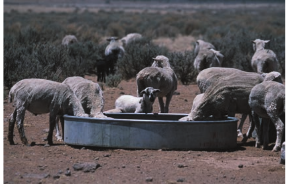
A drought occurs when an area experiences an unusually long period without adequate rainfall, leading to water shortages. What makes a drought significant isn't just the lack of rain, but how this affects people's daily lives and activities. For example, a desert region might have very little rainfall, but this isn't considered a drought because people there have adapted their lifestyles to these conditions.
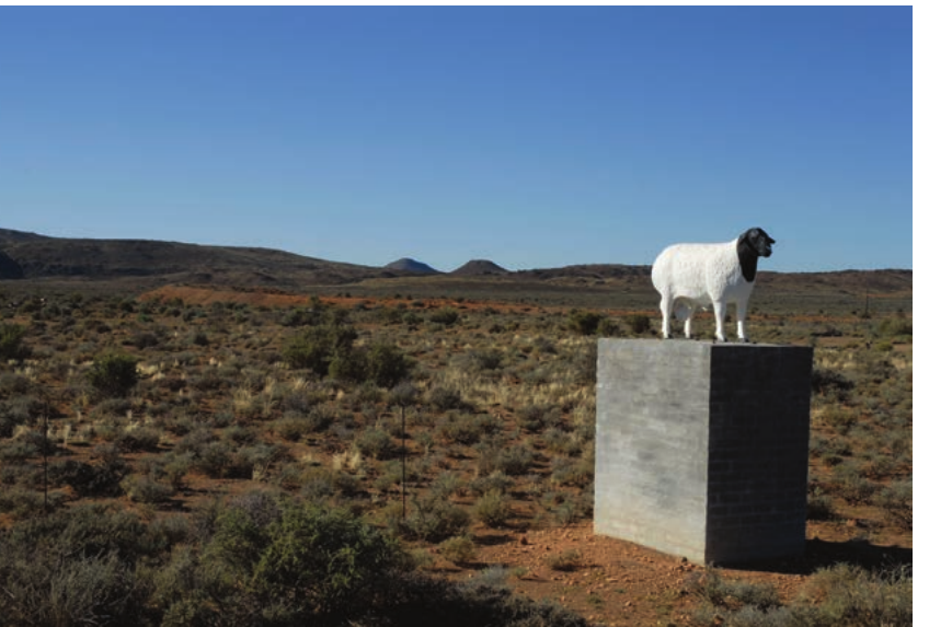
Desertification represents a more permanent change where productive land in semi-arid regions gradually transforms into desert-like conditions. This process happens when soil loses its fertility and vegetation cover decreases over time. When land becomes less productive than it once was, we describe it as degraded.
The relationship between drought and desertification is critical to understand. While drought is temporary, repeated droughts can contribute to long-term desertification, making land permanently less useful for agriculture and other human activities.
Global patterns of risk
Areas in Africa at risk of drought and desertification
Africa faces significant challenges from both drought and desertification, with three main regions showing the highest vulnerability. These areas share common characteristics - they're all located in semi-arid zones where rainfall is already limited and variable.
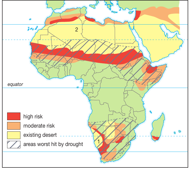
The Sahel region represents the most extensive area at risk. This strip of land runs along the southern border of the Sahara Desert across northern Africa. The Sahel acts as a transition zone between the desert to the north and more fertile lands to the south, making it particularly vulnerable to changes in rainfall patterns.
The Horn of Africa, located in the northeastern part of the continent, experiences frequent drought conditions. This region includes countries like Ethiopia, Somalia, and parts of Kenya, where irregular rainfall patterns create ongoing challenges for agriculture and water supply.
The third major risk area includes lands bordering the Kalahari Desert in southern Africa. Like the other regions, this area experiences the pressures of being adjacent to existing desert conditions, with limited and unreliable rainfall.
All three high-risk African regions share the characteristic of being transition zones - areas that exist between different climate types, making them particularly sensitive to environmental changes.
Areas in South Africa at risk of drought and desertification
South Africa shows a clear geographic pattern in drought risk that follows the country's climate zones. The western regions experience much higher drought frequency compared to the eastern areas.
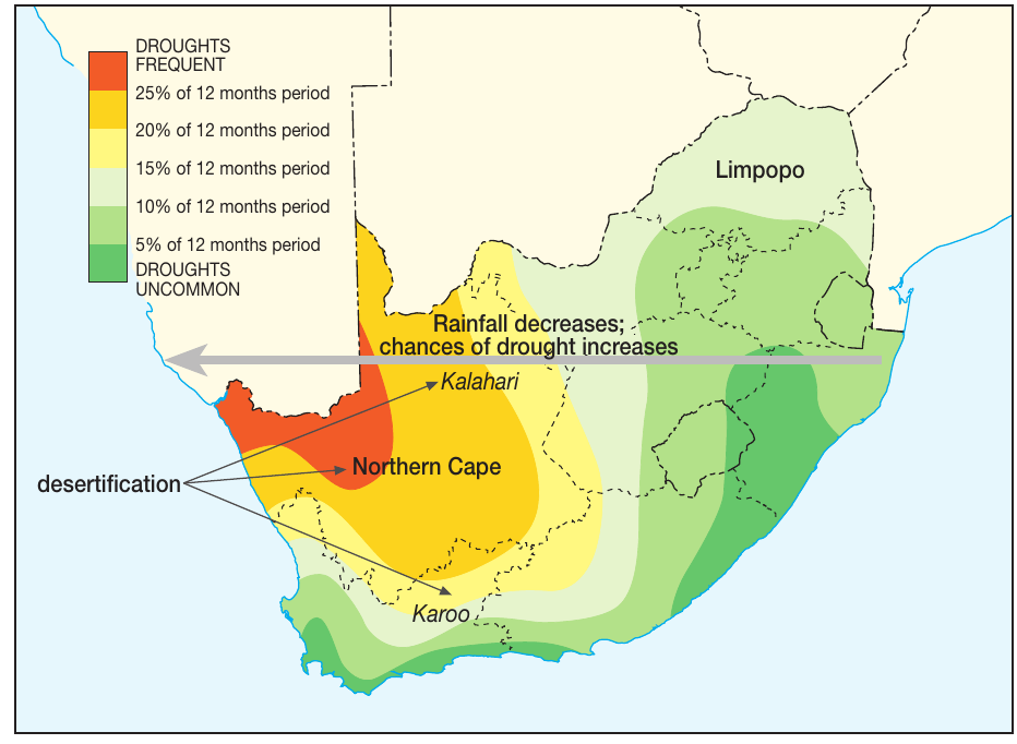
In the western parts of South Africa, including the Northern Cape and Kalahari regions, droughts occur during approximately 25% of twelve-month periods. This high frequency creates ongoing challenges for agriculture, water management, and rural communities.
As you move eastward across the country, drought frequency decreases significantly. The eastern provinces experience drought conditions during only about 5% of twelve-month periods, reflecting the higher and more reliable rainfall in these areas.
Geographic Pattern Demonstration: South Africa's Drought Gradient
Western regions (Northern Cape): ~25% drought frequency
Central regions: Gradual decrease in drought frequency
Eastern regions (KwaZulu-Natal): ~5% drought frequency
This west-to-east pattern directly corresponds to the country's rainfall distribution, with the Indian Ocean providing moisture to eastern areas.
This pattern occurs because South Africa's climate is influenced by different weather systems. The western regions are dominated by dry, high-pressure systems, while the eastern areas receive more moisture from the Indian Ocean.
The implications of these patterns are significant for land use planning, agricultural practices, and rural development strategies. Areas with higher drought frequency require different approaches to farming, water conservation, and economic development.
Regional characteristics and vulnerability factors
Several factors contribute to making certain areas more vulnerable to drought and desertification. Semi-arid regions are particularly at risk because they exist on the margins between dry and wet climates. Small changes in rainfall patterns can have dramatic effects on these marginal lands.
Common Vulnerability Factors to Avoid:
- Overgrazing that removes protective vegetation cover
- Inappropriate farming practices that deplete soil nutrients
- Deforestation that disrupts local water cycles
- Poor land management during drought periods
These human activities can accelerate the process of land degradation, making areas more susceptible to desertification during drought periods.
Climate change adds another layer of complexity, as shifting weather patterns may alter traditional rainfall distributions and increase the frequency or severity of drought conditions in vulnerable regions.
Key Points to Remember:
- Drought is about water shortage, not just low rainfall - it's defined by how rainfall shortage affects human activities and natural systems
- Three main African regions face highest risk: the Sahel (bordering Sahara), Horn of Africa, and areas bordering the Kalahari Desert
- Desertification is a permanent change where productive land gradually becomes desert-like through soil degradation and vegetation loss
- Geographic patterns are predictable - in South Africa, drought risk decreases from west to east following climate zones
- Semi-arid regions are most vulnerable because they exist on the margins between dry and wet climates, making them sensitive to small changes in rainfall