Maps (Grade 12 NSC Matric Mathematical Literacy): Revision Notes
Maps
Maps are visual representations that help us understand spaces, locations, and routes in our world. They come in many different forms and serve various purposes, from helping us navigate buildings to planning long-distance travel routes.
Types of maps
Floor plans and seating charts
Floor plans are overhead views that show the layout of buildings, rooms, or specific areas. They help us understand how spaces are organised and where different facilities are located.
A common example is a cinema seating plan, which shows:
- Available seats (usually in light colours)
- Booked seats (typically shown in dark colours)
- Wheelchair accessible areas (marked with special symbols)
- The screen location and aisles

These plans use legends to explain what different colours and symbols mean, making them easy to interpret. Always check the legend first before trying to understand any map or floor plan.
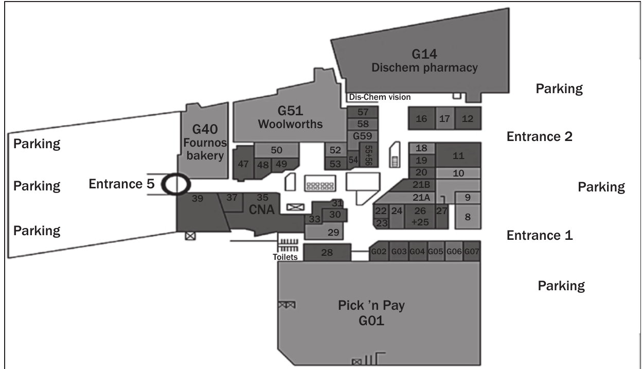
Shopping centre maps
Shopping centre floor plans show the layout of stores, facilities, and navigation routes. They typically include:
- Store locations with numbers or names
- Entrances and exits
- Facilities like toilets, lifts, and escalators
- Parking areas
- Emergency exits
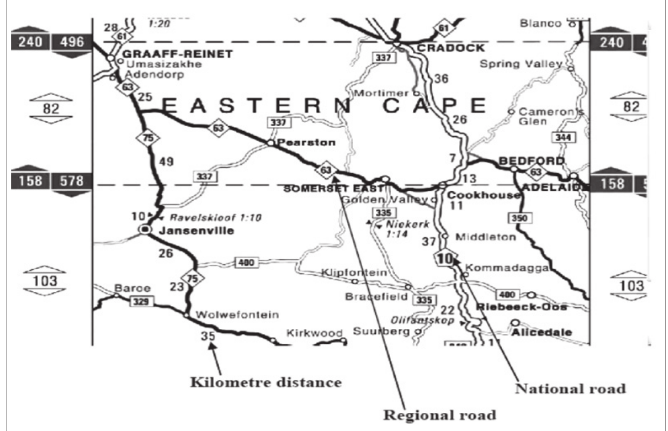
Road maps
Road maps display the road network connecting different towns and cities. They show:
- National roads (major highways connecting cities)
- Regional roads (smaller roads connecting towns)
- Distance markers between locations
- Town and city names
- Compass directions
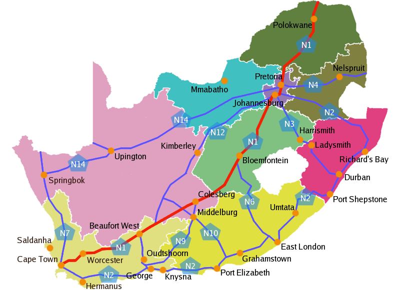
Road maps help you plan journeys by showing the best routes and estimating travel times based on distances.
Elevation maps
Elevation maps show changes in height along a route or across an area. They display:
- Height measurements (usually in metres)
- Distance along the route
- Significant landmarks or checkpoints
- Terrain changes from high to low elevations
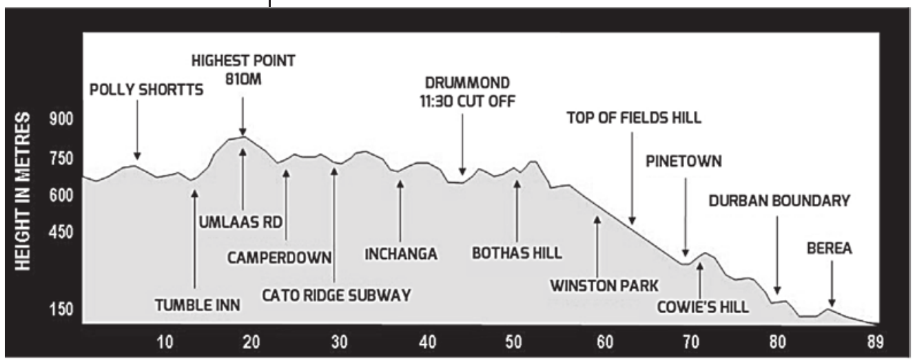
These maps are particularly useful for activities like hiking, cycling, or understanding the difficulty of a route. The steeper the line on an elevation map, the more challenging that section of the route will be.
Map symbols and legends
Maps use symbols as a shorthand way of showing information clearly. These symbols are standardised internationally, so they mean the same thing regardless of language. Always check the legend or key on a map to understand what symbols and colours represent.
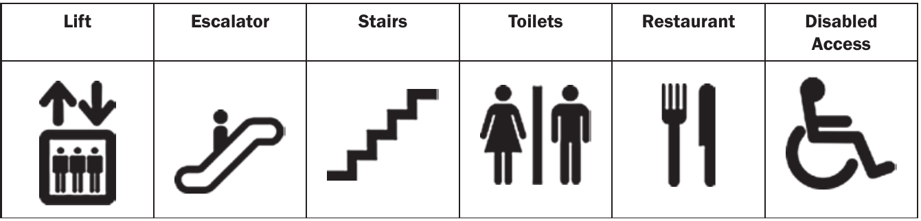
Common universal symbols help you quickly identify facilities and features without needing to read detailed text descriptions.
Reading maps effectively
Using scale and calculating distances
Scale shows the relationship between distances on the map and real-world distances. It's usually written as a ratio like , which means:
- 1 centimetre on the map = 500,000 centimetres in reality
- This equals 1 cm = 5 kilometres
To calculate real distances:
- Measure the distance on the map (in cm)
- Multiply by the scale factor
- Convert to appropriate units (km, m, etc.)
The formula for distance calculation is:
Worked Example: Scale Calculation
If two towns are 3 cm apart on a scale map:
- Real distance =
Finding directions
Maps typically show compass directions:
- North (N) - towards the top
- South (S) - towards the bottom
- East (E) - towards the right
- West (W) - towards the left
You can also use combinations like:
- North-east (NE) - between north and east
- South-west (SW) - between south and west
Memory Aid for Compass Directions: Remember "Never Eat Soggy Waffles" to recall the order: North, East, South, West (clockwise from the top).
Navigation techniques
When using maps for navigation, follow these key steps:
- Find your current location using landmarks
- Identify your destination on the map
- Plan your route by following roads or paths
- Note reference points along the way
- Check distances to estimate travel time
Worked examples
Worked Example: Cinema Seating
Using the cinema seating plan, if you want good seats with a clear view:
- Best choice: Middle sections (seats E, F, G, H) as they're not too close or far from the screen
- Wheelchair access: Available in designated areas marked with the wheelchair symbol
- Availability: Check the legend - avoid black (booked) seats
Worked Example: Shopping Centre Navigation
To navigate from one store to another:
- Locate your starting point (e.g., Entrance 1)
- Find your destination store (e.g., Woolworths G51)
- Plan the route using corridors and landmarks
- Note facilities like lifts or toilets along the way
Worked Example: Road Map Calculations
From the Eastern Cape map, to travel from Graaff-Reinet to Adelaide:
- Route: Use regional road R63
- Distance calculation: Add the kilometre markers: km
- Direction: North-easterly from Graaff-Reinet
Worked Example: Scale Conversion
If the map distance between two points is 3 cm and the real distance is 15 km:
- Scale ratio =
- Simplified =
- As a standard ratio =
Worked Example: Elevation Interpretation
Using an elevation profile:
- Highest point: Located at the peak of the graph
- Steepest sections: Where the line goes up or down most sharply
- Distance markers: Read along the horizontal axis
- Height changes: Read from the vertical axis
Common Mistakes to Avoid:
- Don't forget to check the scale before calculating distances
- Always look at the legend before interpreting symbols
- Remember that smaller scale numbers mean more detailed maps (e.g., 1:50,000 is more detailed than 1:500,000)
Key Points to Remember:
- Always check the legend - it explains what symbols, colours, and markings mean on any map
- Understand the scale - this tells you how to convert map distances to real distances using the formula: Real distance = Map distance × Scale factor
- Use reference points - landmarks help you stay on track when navigating
- Consider the map type - floor plans, road maps, and elevation maps serve different purposes
- Practice distance calculations - multiply map measurements by the scale factor to find real distances
- Remember compass directions - Never Eat Soggy Waffles (N-E-S-W)