Methods and secondary data (Edexcel GCSE Geography A): Revision Notes
Methods and secondary data
When conducting coastal fieldwork investigations, you need to understand different techniques and methods available to collect reliable data. This knowledge helps you choose appropriate methods and avoid errors during your field investigation.
Understanding fieldwork methods
Fieldwork methods can be divided into two main categories that serve different purposes in coastal investigations.
Understanding the Two Main Approaches
Coastal fieldwork uses two distinct methodological approaches, each serving specific purposes in your investigation. Understanding when and how to apply each approach is essential for collecting comprehensive and reliable data.
Quantitative methods are techniques that collect numerical data that can be measured and analysed statistically. These methods produce objective results that can be compared and used for calculations. For coastal studies, quantitative methods help measure physical features like beach gradients, wave heights, or sediment size.
Qualitative methods focus on collecting descriptive information that cannot be easily measured as numbers. These methods record observations about coastal landforms, processes, and characteristics. They provide valuable context and help explain the 'why' behind the numerical data you collect.
Measuring sediment characteristics
One important quantitative method for coastal fieldwork is measuring sediment roundness using the Powers' roundness index. This systematic approach helps geographers assess how far sediments have travelled and what processes have affected them.
Powers' Scale Classification System
The Powers' scale classifies sediment shape into six categories: very angular, angular, sub-angular, sub-rounded, rounded, and well-rounded. Angular sediments typically indicate recent erosion or short transport distances, while well-rounded particles suggest extensive transport by waves and currents.
This method proves effective because it allows researchers to make objective comparisons between different beach locations. By comparing sediment samples with standardised photographs, investigators can avoid subjective judgements and ensure consistent results across different team members.
Secondary data sources
Secondary data refers to information that has already been collected by other organisations or researchers. In coastal investigations, these sources provide valuable background information and help support your primary fieldwork findings.
Geology Maps as Essential Resources
Geology maps represent one of the most useful secondary data sources for coastal studies. The British Geological Survey (BGS) Geology of Britain viewer provides detailed information about rock types and geological structures along coastlines, helping explain coastal development patterns.
Geology maps represent one of the most useful secondary data sources for coastal studies. The British Geological Survey (BGS) Geology of Britain viewer provides detailed information about rock types and geological structures along coastlines. These maps help explain why certain coastal features develop in specific locations and how different rock types respond to coastal processes.
For example, geology maps can reveal whether headlands consist of resistant limestone and chalk, whilst bays form in areas of softer clays and sands. This information helps explain coastal morphology and supports conclusions drawn from fieldwork observations.
Additional secondary sources might include Ordnance Survey maps, historical photographs, climate data, or previous research studies. Your teacher will likely suggest specific sources relevant to your investigation location.
Evaluating secondary data
Critical Considerations for Secondary Data Use
When using secondary data, you must consider both advantages and disadvantages. These sources provide professional, accurate information collected using standardised methods, but they might not cover your specific research questions or study area in sufficient detail.
Secondary data works best when combined with primary fieldwork data. The existing information provides context and background knowledge, whilst your fieldwork addresses specific questions about local conditions and recent changes.
Method selection and appropriateness
Choosing appropriate methods depends on your investigation aims and the coastal environment you're studying. Consider practical factors like safety, weather conditions, and available equipment when planning your fieldwork approach.
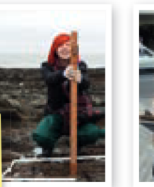
Different tools serve different purposes in coastal investigations. A clinometer measures beach gradients quantitatively, providing precise angle measurements for different beach sections.

Questionnaires represent a qualitative approach to collecting information about coastal management issues, gathering opinions and experiences from local residents or visitors.
Matching Methods to Research Goals
Understanding when to use quantitative versus qualitative methods helps ensure your investigation produces reliable, relevant results that address your research questions effectively. The key is selecting techniques that align with your specific investigation objectives.
Remember!
Key Points to Remember:
-
Quantitative methods collect numerical data (like sediment size measurements using Powers' roundness index), whilst qualitative methods gather descriptive information (like landform observations)
-
Secondary data sources, particularly geology maps from BGS, provide essential background information to support your coastal investigation findings
-
Method appropriateness depends on your research aims - choose techniques that will effectively answer your specific investigation questions
-
Combining different approaches - using both primary fieldwork and secondary data sources - creates a more comprehensive and reliable investigation
-
Consider practical limitations when selecting methods, including safety, weather conditions, and available equipment for your coastal fieldwork