Storms (Junior Cert Geography): Revision Notes
Storms
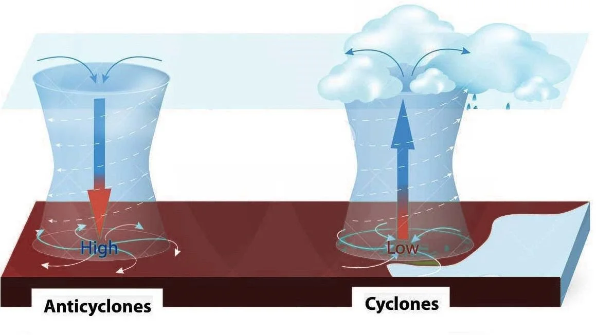
Anticyclones
An anticyclone is an area of high atmospheric pressure, also known as a "high". It is characterised by descending (falling) air.
- High pressure occurs at the centre of an anticyclone. As the air descends, it warms up.
- The warmer air absorbs moisture, meaning clouds do not form.
- Air moves in a clockwise direction from the centre of the anticyclone to areas of lower pressure around it. This creates gentle winds.
- In the Northern Hemisphere, winds in an anticyclone travel clockwise.
- On weather maps, an anticyclone is marked with the letter 'H'.
Anticyclone Weather
Anticyclones are associated with calm, dry weather and clear skies.
- Condensation does not occur because descending air is warmed, leading to little cloud formation.
- During summer, anticyclones bring hot and sunny weather to Ireland.
- In winter, they can cause cold, frosty conditions. The clear skies at night allow heat to escape, making it colder.
- Winds in an anticyclone are light because the air is sinking and is less influenced by the Earth's rotation.
- Anticyclones often lead to dry weather as clouds are less likely to form when the air warms and absorbs moisture.
Depressions
A depression, also known as a "low" or "cyclone", is an area of low atmospheric pressure. It forms when a warm air mass meets a cold air mass, forcing the warm air to rise over the colder, denser air. As the warm air rises, it cools and condenses, forming clouds and leading to precipitation. This process creates the unsettled, wet, and windy weather typically associated with depressions.
- Depressions develop along a front, the boundary between the warm and cold air masses.
- The warm air, being lighter, rises above the cold air, leading to cloud formation and rainfall.
- Depressions often occur in Ireland, especially in winter, where warm, moist air from the southwest meets cold air from the north or northeast.
- On weather maps, depressions are indicated by the letter 'L', representing low pressure.
Depression Weather
Depressions bring cloudy, rainy, and windy weather as they pass over an area.
- Before the depression arrives: Cirrus clouds form high in the sky.
- As the warm front approaches: Air pressure drops, stratus clouds form, and continuous rainfall begins.
- In the warm sector: Cloud cover persists, and temperatures rise slightly.
- When the cold front passes: Temperatures drop, cumulus clouds form, and blustery showers occur.
- Winds are strong within a depression, due to the tight pressure gradient.
- Deep depressions can cause particularly stormy weather, with strong winds and heavy rain.
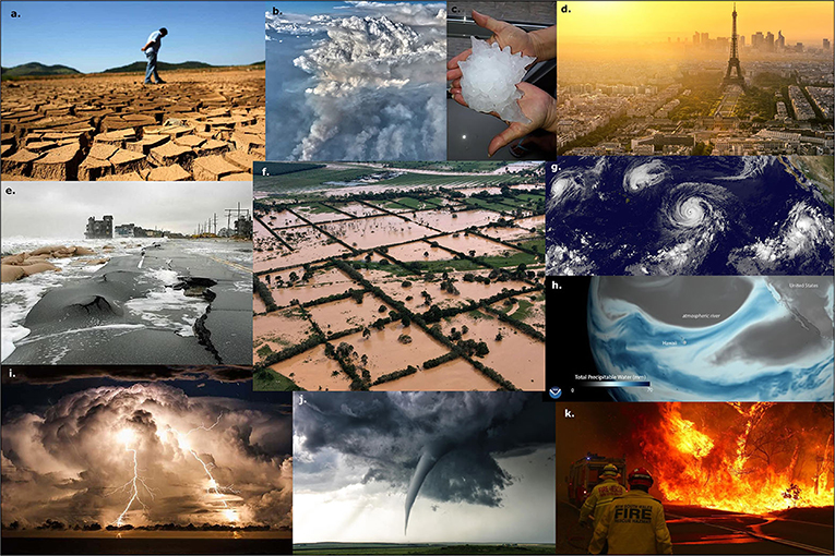
Extreme Weather
Extreme weather events occur when weather conditions become unusually severe or intense, often causing damage and disruption.
- Heatwaves: Long periods of unusually high temperatures, often leading to drought and health risks.
- Hurricanes/Cyclones: Form over warm oceans, bringing very strong winds, torrential rain, and storm surges.
- Tornadoes: Violently rotating columns of air, producing extreme winds that can destroy buildings and uproot trees.
- Floods: Caused by heavy rainfall, river overflow, or coastal storm surges, leading to widespread damage and displacement.
- Blizzards: Severe snowstorms with strong winds and low visibility, making travel dangerous.
- Extreme weather events are becoming more frequent and intense due to climate change.