Comparing OS Maps and Aerial Photographs (Leaving Cert Geography): Revision Notes
📚 Revision Notes
Comparing OS Maps and Aerial Photographs
Comparing OS Maps and Aerial Photographs
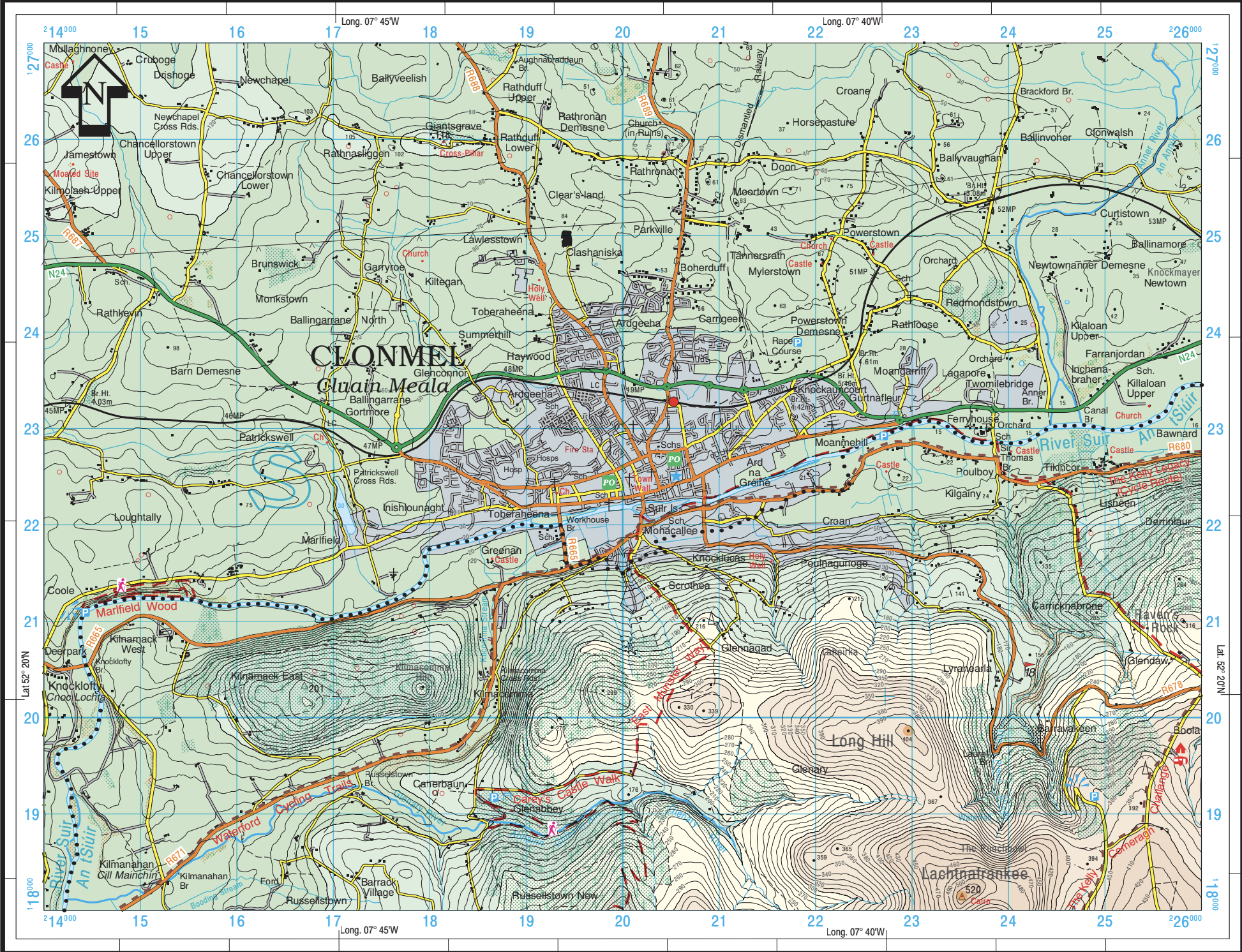
OS Maps
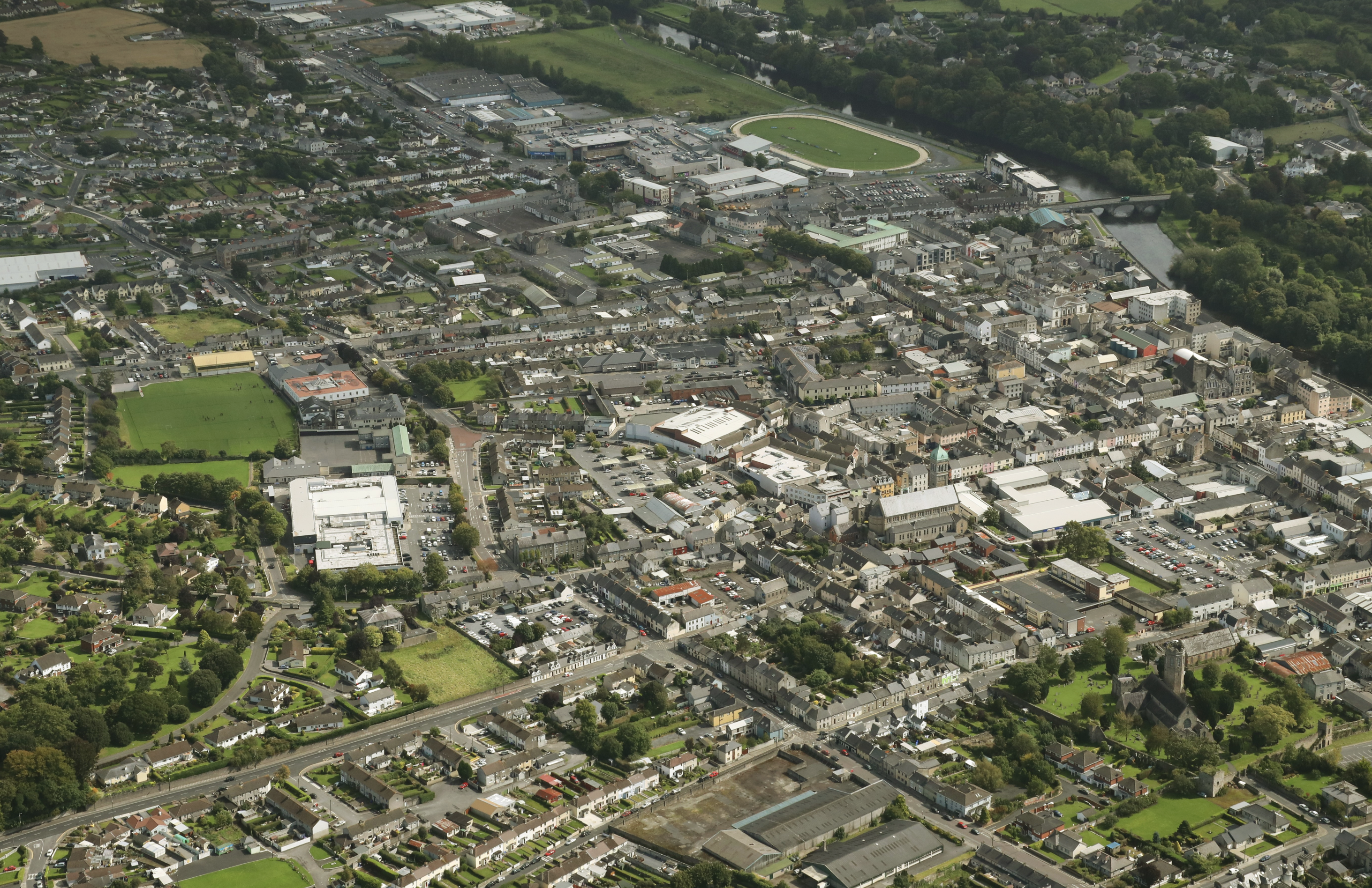
Aerial Photographs
Key Similarities
Represent the Same Area
- Both OS maps and aerial photographs often depict the same geographical area, enabling cross-referencing of features.
Show Physical and Human Features
- Physical Features:
- Landforms such as rivers, mountains, and forests are visible in both.
- Human Features:
- Settlements, transport networks, and land use are depicted in detail.
Tools for Analysis
- Both can be used to study:
- Relief (elevation and slopes).
- Land use patterns.
- Transport and settlement development.
Key Differences
| Feature | OS Maps | Aerial Photographs |
|---|---|---|
| Perspective | Planimetric (top-down view) | Bird's-eye view (angled or vertical) |
| Symbols | Uses a legend to represent features | Shows actual visuals of features |
| Relief | Contour lines, spot heights, and shading | Shadows and textures to infer elevation |
| Detail | Simplified, focusing on key features | Highly detailed, showing all visible features |
| Scale | Fixed (e.g., 1:50,000) | Can vary and must often be estimated |
How to Compare OS Maps and Aerial Photographs
Identifying Features
- Match features like roads, rivers, and buildings between the map and photograph.
Analysing Relief
- OS Maps: Use contour lines to determine elevation and slope.
- Aerial Photographs: Look at shadows and textures to interpret height and shape.
Studying Patterns
- Compare settlement layouts, such as nucleated, linear, or dispersed patterns.
- Observe transport networks and their connections.
Understanding Land Use
- OS maps use symbols to represent land use (e.g., forests, agriculture).
- Aerial photographs visually display the landscape, allowing for detailed land-use interpretation.
Applications of Comparing OS Maps and Aerial Photographs
Fieldwork and Investigation
- Cross-reference maps with photographs to confirm locations and analyse spatial relationships.
Urban and Rural Studies
- Analyse settlement growth, land-use changes, and transport networks by combining the two sources
Tips for Effective Comparison
- Use the map's legend and the photograph's visual details to identify corresponding features.
- Pay attention to scale and orientation to align both correctly.
- Practice comparing OS maps and photographs from past papers to build confidence.