The South African Map Referencing System (Grade 10 NSC Matric Geography): Revision Notes
The South African Map Referencing System
What are topographic maps?
A topographic map is a special type of map that shows both natural and human-made features on the Earth's surface drawn to scale. These maps are incredibly useful because they provide detailed information about the landscape, including mountains, rivers, roads, buildings, and settlements. Think of them as detailed "pictures" of the land that help us navigate and understand our environment.
The scale aspect of topographic maps is crucial - it means that distances and features on the map maintain accurate proportional relationships to their real-world counterparts, making these maps reliable tools for navigation and planning.
The national grid system
South Africa uses a systematic approach to organise its topographic maps. The National Geo-spatial Information (NGI) is a division of the Department of Rural Development and Land Reform that takes responsibility for creating, maintaining, updating, and distributing topographic maps throughout South Africa.
To make it easier for people to find and obtain maps of specific areas, NGI has developed a comprehensive map referencing system that applies to all South African 1:50 000 scale maps. This system works by dividing the entire country into a organised grid pattern.
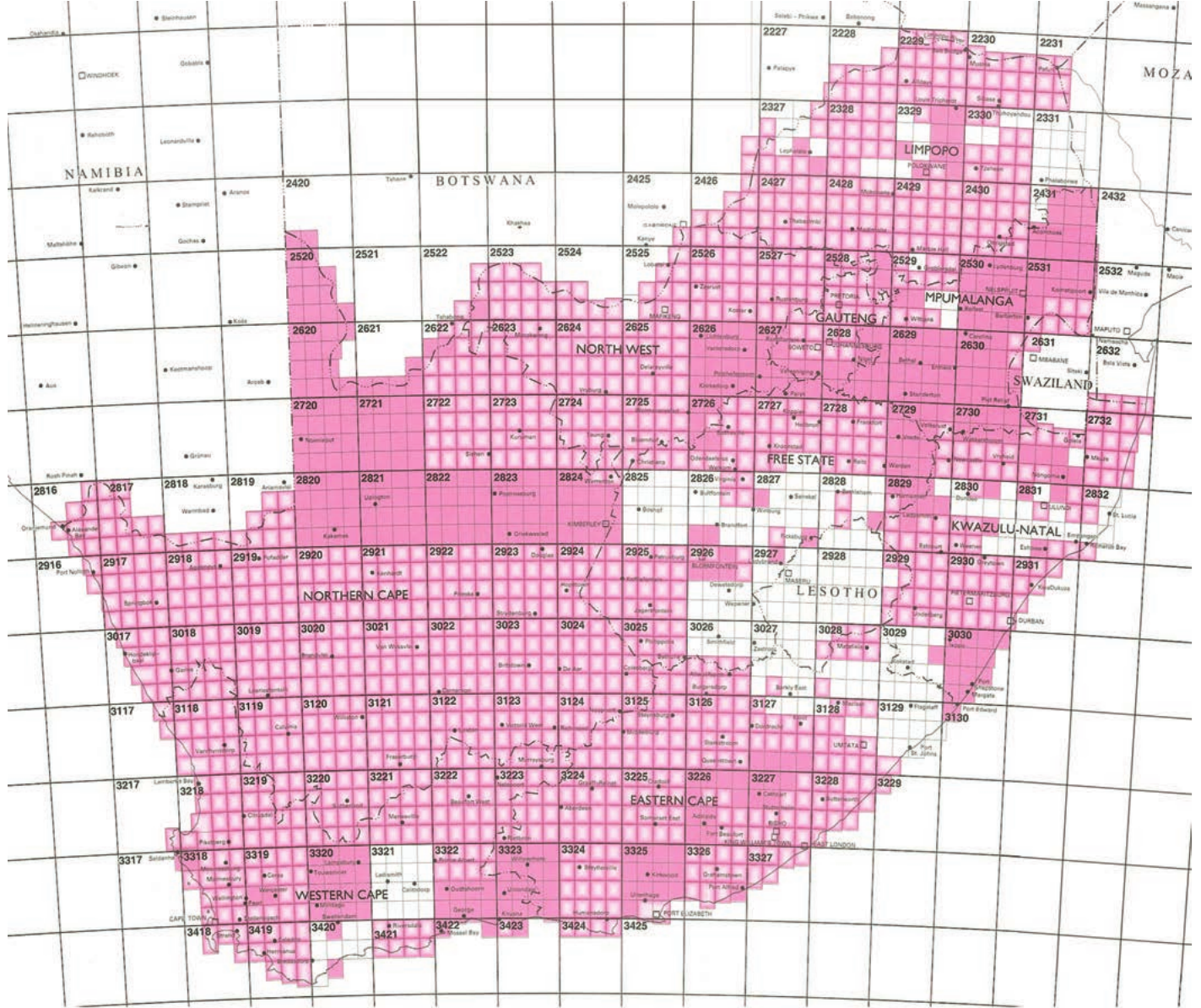
The map above shows how South Africa has been divided into squares, with each square representing one degree of latitude by one degree of longitude. Each of these large squares has been further subdivided into sixteen smaller squares, each measuring 15 minutes by 15 minutes (written as 15' × 15').
Understanding map reference numbers
Every topographic map in South Africa has a unique map reference number that helps identify its exact location. This number is allocated to each 1:50 000 topographic map in the Index of the South African map series.
Map reference numbers consist of both letters and numbers, creating a systematic identification system that pinpoints exact locations within the national grid.
Worked Example: Understanding the Douglas Map Reference
The Douglas map has the reference number 2923BB. Let's break this down step by step:
Step 1: Identify the coordinate numbers
- The numbers 29 and 23 represent the coordinates
- 29 represents 29°S (latitude - how far south)
- 23 represents 23°E (longitude - how far east)
Step 2: Understand the letter system
- The letters (BB) represent the position of the map within the subdivided block
- The first B indicates the top-right quadrant of the degree square
- The second B indicates the top-right subdivision of that quadrant
Step 3: Remember the reference point
- These coordinates refer to the north-west corner of the map
The latitude and longitude coordinates of the north-west corner of each map are used to create the reference number. This system ensures that every map has a unique identifier that tells you exactly where it fits in the national grid.
How coordinates work
The coordinate system uses degrees and minutes to pinpoint locations. This creates a precise grid system that allows for accurate map referencing across the entire country.
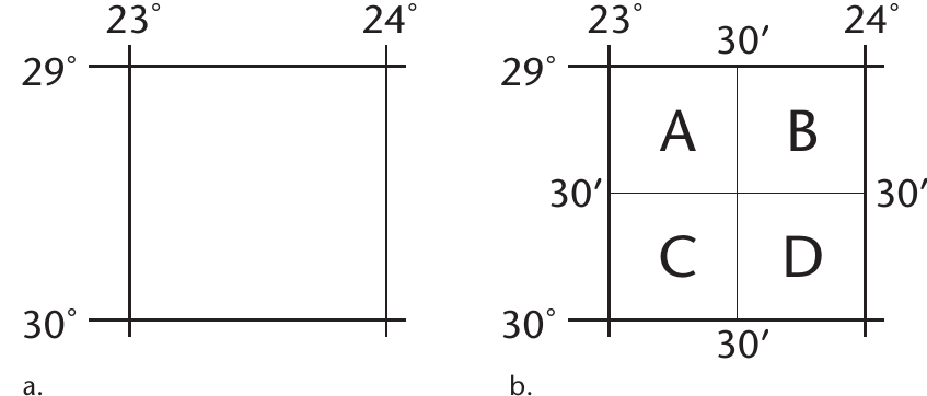
The diagrams above show how a basic degree square can be subdivided for more precise referencing. In diagram (a), you can see a simple one-degree square. In diagram (b), the same square has been divided into four equal parts using 30-minute intervals, creating quadrants labelled A, B, C, and D.
Subdividing map squares
For even more detailed referencing, these quadrants can be further subdivided. The process works as follows:
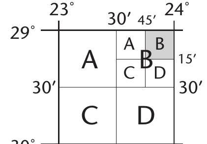
The subdivision follows a systematic pattern:
- Each degree square is first divided into four 30' × 30' squares (labelled A, B, C, D)
- Each of these can be further subdivided into four 15' × 15' squares (also labelled A, B, C, D)
- This creates the two-letter system used in map reference numbers
The letters follow a consistent clockwise pattern starting from the top-left:
- A = top-left (north-west)
- B = top-right (north-east)
- C = bottom-left (south-west)
- D = bottom-right (south-east)
This pattern never changes and is essential for correctly interpreting map reference numbers.
So in the Douglas example (2923BB), the first B indicates it's in the top-right quadrant of the degree square, and the second B means it's in the top-right subdivision of that quadrant.
Practical applications
This referencing system creates numerous advantages for map users and professionals alike:
Key Benefits of the Map Referencing System:
The systematic approach makes it incredibly efficient to:
- Locate specific maps you need for an area
- Order maps from NGI or map retailers
- Coordinate with others about specific locations
- Navigate using precise grid references
- Plan routes and field work
The system covers not only South Africa but also neighbouring countries like Namibia, Botswana, Mozambique, Swaziland, and Lesotho, making it useful for regional planning and cross-border activities.
Exam tips
Essential Points for Map Reference Success:
When working with map reference numbers, remember these crucial guidelines:
- Always start with the north-west corner coordinates
- Remember that the first number is latitude (north-south position)
- The second number is longitude (east-west position)
- Letters follow the A, B, C, D pattern in clockwise order from top-left
- Practice identifying the reference numbers of maps in your local area
Common mistake to avoid: Don't confuse the order of latitude and longitude - latitude always comes first in South African map references.
Key Points to Remember:
- Topographic maps show both natural and human features drawn to scale
- NGI is responsible for maintaining South Africa's topographic mapping system
- Map reference numbers use coordinates from the north-west corner plus letter codes
- Grid squares are systematically divided from 1° × 1° down to 15' × 15'
- The letter system follows A, B, C, D in clockwise order starting from the top-left
- This system makes it easy to locate and order specific maps for any area in South Africa