Map Projections (Grade 10 NSC Matric Geography): Revision Notes
Map Projections
What are map projections?
A map projection is a method used to show the round shape of the Earth as a flat map. This might sound straightforward, but it creates one of geography's biggest challenges. Think about it - how do you take something that's perfectly round, like our planet, and make it completely flat without changing its appearance?
All maps in atlases are flat maps, even though they represent our round world. Map projections are the techniques cartographers (map-makers) use to convert the curved surface of the Earth onto a flat piece of paper. However, this process is extremely difficult to do whilst keeping the same size and shape of Earth's surface features.
The Fundamental Challenge
It is impossible to represent all the properties of size, shape, area, direction and distance between places accurately on one flat map. Every map projection must sacrifice some accuracy to maintain others.
Understanding the challenge through experimentation
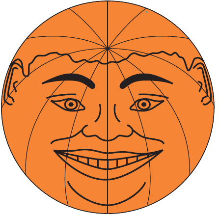
To understand why map projections are so challenging, geographers often use a simple experiment with an orange (or naartjie). This practical activity helps demonstrate the fundamental problem that cartographers face.
Worked Example: The Orange Peel Experiment
What you need:
- An orange or naartjie
- A felt-tip pen
The experiment steps:
- Draw a face on the fruit showing the top, side, front and back views
- Carefully peel the fruit, trying to keep the peel in one piece
- Flatten out the peel completely
- Compare the flattened face with your original drawing
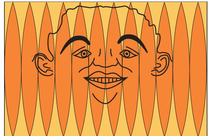
What happens: When you flatten the orange peel, you'll notice that the face looks very different from what you originally drew. The features become stretched and distorted.
This is exactly the same problem that map-makers experience when trying to show the round Earth on flat maps. They cannot represent all the properties of size, shape, area, direction and distance between places accurately on one flat map.
Types of map projections
Because it's impossible to maintain all geographical properties perfectly, cartographers have developed different types of projections. Each type preserves some properties well but sacrifices others. There are two main types you need to understand: equal-area projections and true-direction projections.
Equal-area projections
Equal-area projections are designed to show land areas accurately. The Lambert's projection is a well-known example of this type.
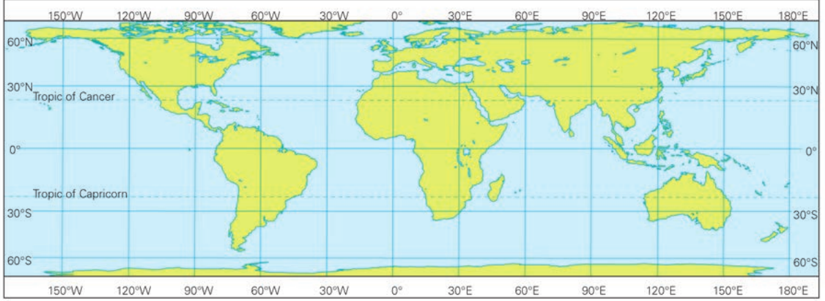
An equal-area projection accurately represents the size relationships between different areas on Earth. This means that if you compare the area of Africa with Europe on this type of map, the proportion (relationship between the sizes) will be exactly the same as it is in reality.
Understanding Proportion
If Africa is actually ten times larger than Europe, it will appear ten times larger on an equal-area projection. This consistency in size relationships is what makes equal-area projections so valuable for geographical comparison.
However, notice how this projection 'stretches' the land masses near the north and south poles. This is the trade-off - whilst areas are accurate, shapes become distorted, especially closer to the poles. Antarctica, for instance, appears much wider than its actual shape.
Values of equal-area projections:
- Show the area of land on Earth's surface accurately as it exists in reality
- Perfect for comparing the size of different countries or continents
- All points on the projection show accurate true bearings from the centre of the map
Limitations of equal-area projections:
- Distort the shape of continents, especially near the poles
- Greatest distortion occurs closest to the polar regions
- Do not show direction between places accurately across the entire map
True-direction projections
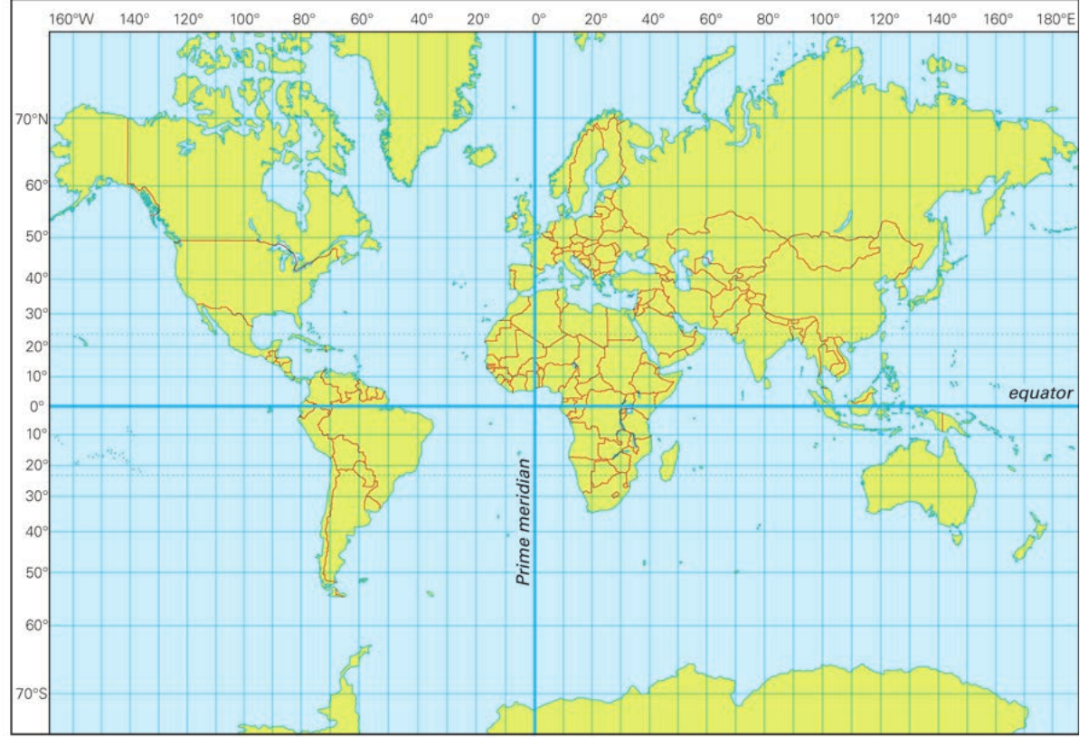
Geographers would ideally like to preserve four key properties on flat maps: accurate direction between places, accurate distances between locations, accurate areas, and accurate shapes. Unfortunately, this is impossible, so true-direction projections focus on maintaining accurate compass bearings and directions.
The most famous example is the Mercator projection, which was originally designed to help sailors navigate the world's oceans accurately.
Navigation Revolution
The Mercator projection became the standard for navigation because sailors could draw a straight line between any two points and follow that compass bearing to reach their destination. This was revolutionary for maritime exploration and trade.
Values of true-direction projections:
- Preserve the correct shape of countries and continents
- Show accurate compass bearings between any two points
- Extremely useful for navigation purposes, especially at sea
Limitations of true-direction projections:
- The scale is only correct at the equator
- Severely distort the size of countries further from the equator
- Areas above 80°N and below 80°S are enlarged up to six times their actual size
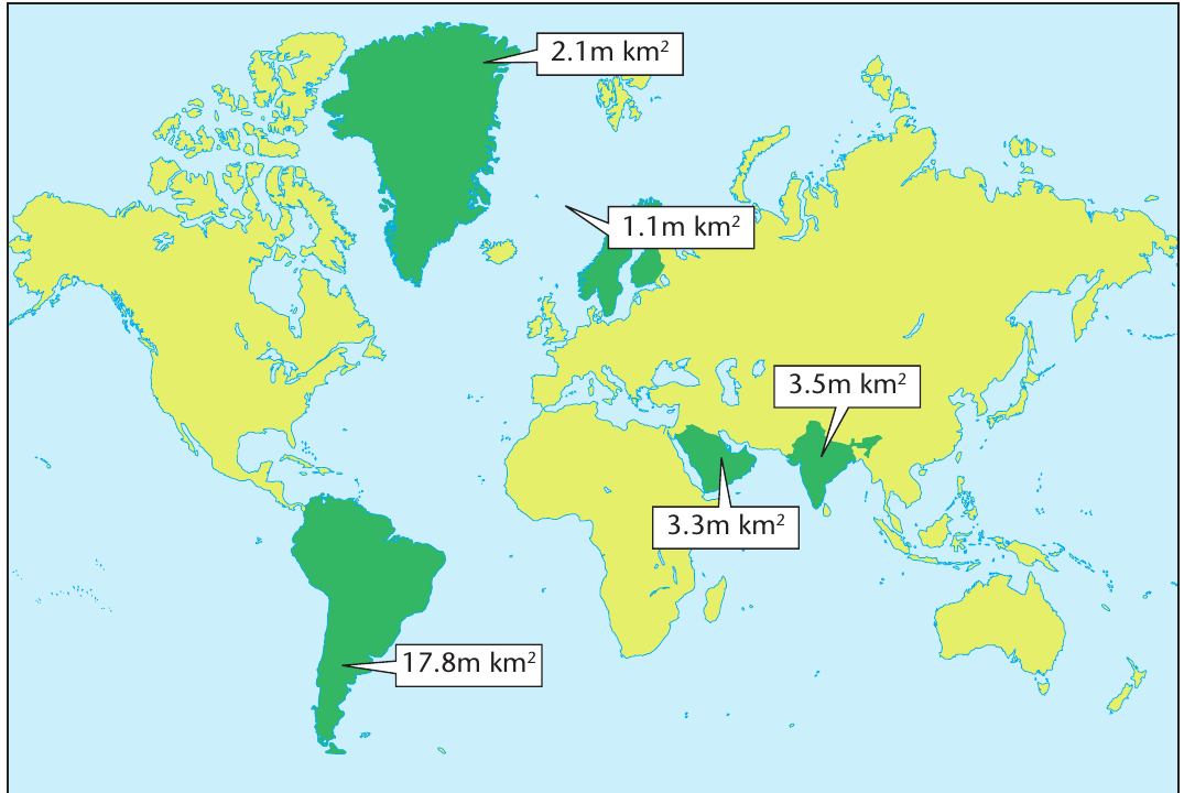
Size Distortion Example
This explains why Greenland appears almost as large as Africa on many world maps, when in reality Africa is about 14 times larger than Greenland!
Comparing projection types
Different projections serve different purposes. If you want to compare the actual sizes of countries or continents, you should use an equal-area projection like Lambert's. If you need to navigate or find accurate directions between places, a true-direction projection like Mercator's is more suitable.
Choosing the Right Projection
Understanding these differences is crucial when interpreting maps and using atlases. Always consider what type of projection is being used and how this might affect what you're seeing. A country that appears very large on one map might look much smaller on another, depending on the projection used.
Remember!
Key Points to Remember:
- Map projections are necessary because you cannot show a round Earth accurately on a flat map without some distortion
- Equal-area projections (like Lambert's) show accurate sizes but distort shapes, especially near the poles
- True-direction projections (like Mercator's) show accurate compass bearings and shapes but greatly distort sizes away from the equator
- The orange peel experiment demonstrates why all flat maps must involve compromise and distortion
- Choose your projection based on your purpose: equal-area for size comparison, true-direction for navigation