Clouds (Grade 10 NSC Matric Geography): Revision Notes
Clouds
Understanding clouds is one of the most practical skills in weather forecasting. By observing the clouds in the sky, we can predict what weather conditions might occur in the coming hours. This knowledge helps us understand whether a storm is approaching, if rainfall is likely, or if fine weather will continue.
How and why clouds form
Cloud formation requires two essential elements working together: water vapour in the atmosphere and a cooling process that reaches the dew point temperature.
The formation process
When air containing water vapour cools down to its dew point temperature, the invisible water vapour begins to change into tiny visible water droplets through a process called condensation. However, water vapour cannot simply condense by itself in the atmosphere - it needs tiny solid particles to condense onto.
Condensation nuclei are microscopic solid particles floating in the air that provide surfaces for water vapour to condense onto. These particles include dust, volcanic ash, smoke, and salt crystals from sea spray. Without these tiny particles, clouds could not form.
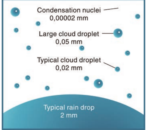
The diagram above shows the incredible difference in size between condensation nuclei (0.0002 mm), typical cloud droplets (0.02 mm), and raindrops (2 mm). This demonstrates how millions of tiny droplets must combine to eventually form precipitation.
Why clouds stay in the sky
Water droplets in clouds are incredibly small and lightweight, which allows them to remain suspended in the air. Rising air currents help keep these water droplets floating in the clouds, whilst evaporation throughout the day adds more water vapour to maintain the cloud formation.

When temperatures drop below 0°C at high altitudes, ice crystals form instead of water droplets. These ice crystals reflect sunlight, which is why we can still see clouds even when they contain ice rather than liquid water.
Cloud classification system
Meteorologists classify clouds into four main families based on the height at which they occur in the atmosphere. Each family has distinct characteristics and weather patterns associated with it.
The four cloud families
The Four Cloud Families by Altitude:
1. Cirrus family - These clouds form higher than 7 km above ground level. At such extreme altitudes, temperatures are so cold that these clouds consist entirely of ice crystals rather than water droplets. Cirrus clouds typically indicate fair weather and produce no precipitation.
2. Alto family - These medium-altitude clouds occur between 3 km and 7 km above ground level. Depending on the temperature at their altitude, they may contain either water droplets or ice crystals. Alto clouds rarely produce precipitation that reaches the ground.
3. Low level clouds - The condensation level for these clouds is below 2 km above ground, so they form relatively close to Earth's surface. These clouds often lead to precipitation and overcast conditions.
4. Vertically developing clouds - Although their base forms below 2 km like low-level clouds, these clouds grow upward due to strong warm rising air currents. They can extend to great heights and often produce dramatic weather conditions.
Cloud shapes and terminology
Within each cloud family, individual clouds are further classified according to their shape. Understanding these shape categories helps identify specific cloud types and their weather implications.
The three main shape categories
Cumulus clouds get their name from the Latin word meaning "heap" or "pile". These clouds appear patchy and fluffy, resembling cotton balls in the sky. They form when warm air rises in distinct parcels, creating individual cloud formations with clear sky visible between them.
Stratus clouds come from the Latin word meaning "layer". These clouds form in wide, horizontal layers that can cover large areas of sky. They appear as broad sheets rather than individual formations and often create overcast conditions.
Nimbus clouds derive their name from the Latin word for "rain". Only two cloud types are true rain-bearing clouds: nimbostratus and cumulonimbus. The presence of "nimbus" in a cloud name indicates it can produce significant precipitation.
Understanding Latin Cloud Names:
- Cumulus = "heap" or "pile" (puffy, individual clouds)
- Stratus = "layer" (flat, sheet-like clouds)
- Nimbus = "rain" (precipitation-producing clouds)
- Cirrus = "curl" (thin, wispy high-altitude clouds)
- Alto = "high" or "middle" (medium altitude designation)
Detailed cloud types by family
Cirrus family (above 7 km altitude)
Cirrus - These thin, wispy clouds composed entirely of ice crystals create delicate, feathery patterns across the sky. They indicate fair weather and produce no precipitation.

Cirrocumulus - High-altitude clouds forming in small, white clumps or patches. They create patterns resembling fish scales across the sky and indicate continued fair weather.

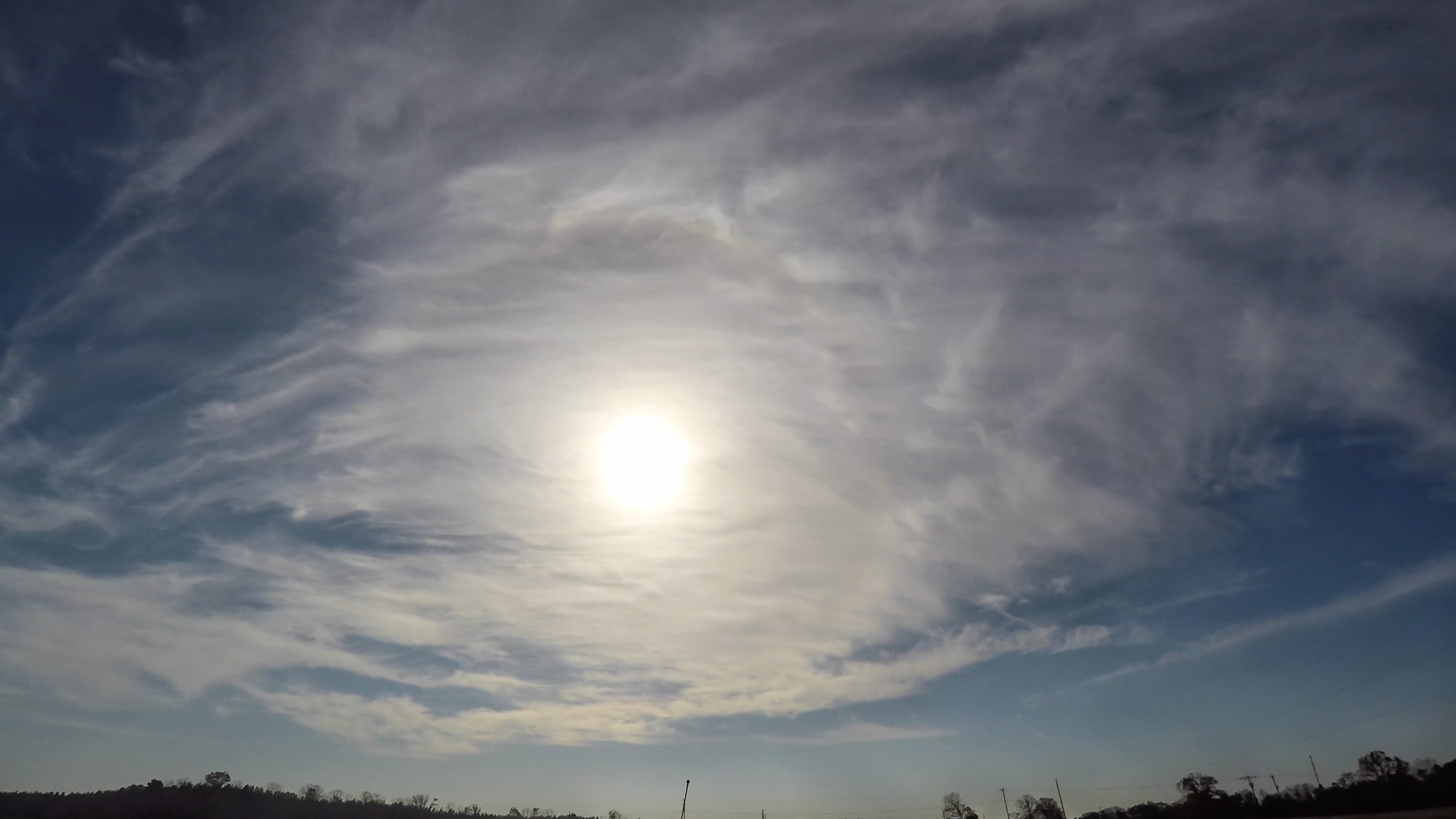
Cirrostratus - These form a thin layer of ice crystals that can cover the entire sky. When positioned in front of the sun or moon, they create spectacular halo effects due to light refraction through the ice crystals.
Alto family (3-7 km altitude)
Altocumulus - These appear as tufts or clumps of cloud between 3 and 7 km above ground. They're generally too high to produce rain that reaches the surface.

Altostratus - Forms a layer of cloud that can cover extensive areas. If the layer becomes thick enough, it may produce light drizzle.

Low level clouds (below 2 km altitude)
Stratus - Low-lying thin layers of cloud that often hang over mountains or create overcast conditions. They typically produce only very light drizzle.

Stratocumulus - These form flat bands of cumulus-type clouds. While they may look threatening, they're usually not deep enough to produce significant rainfall.

Nimbostratus - When thin stratus clouds thicken sufficiently, they become nimbostratus and can produce steady rain or snow.

Vertically developing clouds (base below 2 km)
Cumulus - Fair weather clouds that appear as individual puffy formations. They typically indicate pleasant conditions and don't produce precipitation.

Worked Example: Cumulonimbus Development
Cumulonimbus - These are the giants of the cloud world, growing from small cumulus clouds when strong convection currents develop.
Development process:
- Initial stage: Small fair weather cumulus clouds form
- Growth stage: Strong warming creates powerful updrafts
- Mature stage: Cloud extends through multiple altitude levels (up to 12 km or more)
- Weather production: Heavy rainfall, thunderstorms, lightning, hailstones, and even flash flooding
This demonstrates how dramatic weather conditions can develop from seemingly innocent cumulus clouds.
Weather forecasting with clouds
Different cloud types provide valuable clues about approaching weather conditions. Learning to read these natural weather signs allows you to make informed predictions about changing conditions.
Cloud-Based Weather Prediction Patterns:
- Tall, dark clouds usually indicate an approaching storm system
- Low, grey clouds often suggest rainfall is likely within hours
- High, scattered clouds generally indicate fair weather will continue
- Rapidly building cumulus clouds during the day may develop into afternoon thunderstorms
Understanding these patterns helps predict weather changes and plan outdoor activities accordingly.
Key Points to Remember:
-
Cloud formation requires two elements: water vapour and condensation nuclei (tiny particles for water to condense onto)
-
Four cloud families exist based on altitude: Cirrus (high), Alto (middle), Low level, and Vertically developing clouds
-
Three shape categories define cloud appearance: Cumulus (heaped), Stratus (layered), and Nimbus (rain-bearing)
-
Only two clouds produce significant rain: Nimbostratus and Cumulonimbus are the main precipitation producers
-
Cloud observation predicts weather: Tall dark clouds suggest storms, low grey clouds indicate rain, while high scattered clouds mean fair weather continues