Orthophoto Maps – Identifying Features (Grade 11 NSC Matric Geography): Revision Notes
Orthophoto Maps – Identifying Features
What are orthophoto maps?
An orthophoto map combines two different types of geographical information into one useful document. It merges a topographical map with a vertical aerial photograph to create a detailed and accurate representation of the landscape.
Think of it this way: imagine taking a bird's-eye view photograph of an area and then adding all the useful map information like contour lines, place names, and grid references on top. This creates a powerful tool that shows you both what the land actually looks like from above and provides all the measurement and navigation details you need.
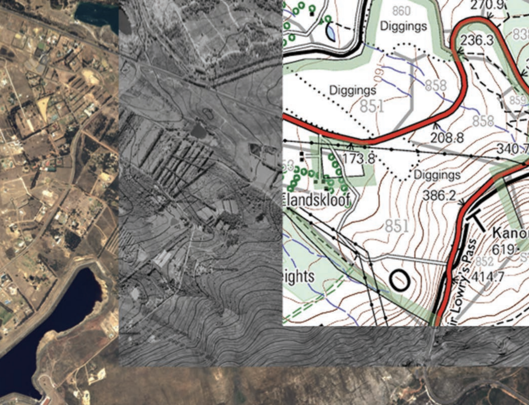
Orthophoto maps are particularly valuable because they provide both the visual reality of aerial photography and the precise measurements of traditional maps. This dual functionality makes them essential tools for urban planning, environmental monitoring, and detailed geographical analysis.
Scale and detail characteristics
Orthophoto maps use a scale of 1:10,000, which means they show much more detail than standard topographical maps. This larger scale allows you to see smaller features and get more precise measurements of distances and areas.
To put this in perspective, the scale of an orthophoto map provides five times more detail than a typical topographical map. This increased detail makes orthophoto maps particularly useful for detailed planning, environmental studies, and precise geographical analysis.
The 1:10,000 scale means that 1 unit on the map represents 10,000 units in reality. For example, 1 centimeter on the map equals 100 meters on the ground. This level of detail allows you to identify individual buildings, small roads, and even large trees.
Map coverage relationships
Understanding how orthophoto maps relate to topographical maps is important for exam purposes. Here's the key relationship you need to remember:
Twenty-five orthophoto maps cover the same geographical area as one topographical map. This means that when you're working with orthophoto maps, you're looking at a much smaller area but with significantly more detail.
Orthophoto maps follow the same naming system as topographical maps, but they include an additional number from 1 to 25 to identify which specific section they represent within the larger topographical map area.
Understanding orthophoto map codes
Orthophoto maps use a systematic coding system that tells you exactly where the map is located. Let's break down how this works using a practical example.
Worked Example: Decoding Map Reference "2430DB 6"
The map code system works like this:
- Latitude and longitude coordinates tell you the general location on Earth
- Large square identification shows which quarter of a major grid square you're looking at
- Small square position indicates the specific subdivision within that quarter
- Map number (1-25) identifies which of the 25 orthophoto maps you're using
Breaking down the code "2430DB 6":
- 2430 represents the latitude and longitude coordinates
- D shows you're looking at the fourth large square (out of four)
- B indicates the second small square (out of four)
- 6 means this is the sixth orthophoto map (out of 25) in that area
How the South African mapping system works
The South African mapping system divides the country into a grid of one-degree squares. Each of these large squares is then subdivided into four smaller squares, labelled A to D. These smaller squares are further divided into twenty-five numbered blocks, with each block representing one orthophoto map.
This hierarchical grid system creates a logical and systematic way to organize geographical information. It ensures that every location in South Africa can be precisely identified using a standardized reference system that cartographers and researchers can easily understand and use.
This systematic approach ensures that every location in the country can be precisely identified and that maps can be easily organised and referenced.
Key Points to Remember:
- Orthophoto maps combine topographical information with aerial photography to show both accurate geographical data and realistic ground appearance
- The scale of 1:10,000 provides five times more detail than standard topographical maps, making them ideal for detailed analysis
- 25 orthophoto maps equal the area of 1 topographical map - remember this key relationship for exam questions
- Map codes contain multiple pieces of information including coordinates, grid position, and specific map number
- The systematic coding system allows precise location identification anywhere in South Africa's mapping grid