Tone, Texture, and Shadows (Grade 11 NSC Matric Geography): Revision Notes
Tone, Texture, and Shadows
When interpreting aerial photographs and orthophoto maps, geographers use three main visual elements to identify and understand different features on the ground. These elements - tone, texture, and shadows - work together to help us recognise everything from buildings and roads to forests and rivers.
Understanding tone in aerial photographs
Tone refers to how light or dark different areas appear in a photograph. Think of it as the brightness or darkness of different features when you look at them from above.
This visual element is incredibly useful for identifying what you're looking at. The tone of an object depends on how much light it reflects back to the camera. Dark objects absorb more light, while bright objects reflect more light.
In colour photographs, tone has additional characteristics:
- Cold tones appear bluish
- Warm tones appear reddish
Examples of tone differences
Different features show distinct tonal patterns that help with identification:
| Darker Tone Features | Lighter/Brighter Tone Features |
|---|---|
| Clear water | Muddy water |
| Vegetation cover | Exposed sand |
| Mature crops | New crops |
| Wet ground | Dry ground |
| Textured surfaces | Smooth surfaces |
| Ploughed fields | Fallow (bare) fields |
| Rivers | Roads |
These tonal differences are particularly useful for determining seasonal changes, water quality, and crop maturity. For example, you can identify tree species by observing the colour of their leaves at different times of the year.
Understanding texture in aerial photographs
Texture describes how smooth or rough different features appear when viewed from above. It gives us information about the physical characteristics of what we're observing.
Texture helps us distinguish between similar-looking features by examining their surface patterns:
- Large, planned urban areas appear smooth and regular, with organised street patterns
- Informal, unplanned structures have a coarse, irregular texture
- Wheatfields and vineyards show regular, striped textures due to organised planting
- Fruit orchards display coarse textures from scattered tree canopies
- Forest canopies appear rough and mottled with patchy patterns
- Cultivated fields give a speckled appearance, especially after machine harvesting creates streaky lines
- Calm water has a smooth texture, while coastal waves appear rough and textured
Understanding shadows in aerial photographs
Shadows provide valuable information about the height, shape, and orientation of objects. Understanding shadows is crucial for proper photograph interpretation and navigation.
Using shadows for orientation
Shadows are particularly useful for determining direction. By examining shadow direction, you can determine which way is north - this is essential for proper map orientation.
Shadow patterns follow predictable rules:
- In the southern hemisphere, shadows fall predominantly on the southern side of raised objects
- In the morning, shadows fall south-west
- In the afternoon, shadows fall south-east
Shadow information
The time when a photograph was taken affects shadow length and direction. Longer shadows occur when the sun is lower (early morning or late afternoon), while shorter shadows occur when the sun is higher (midday).
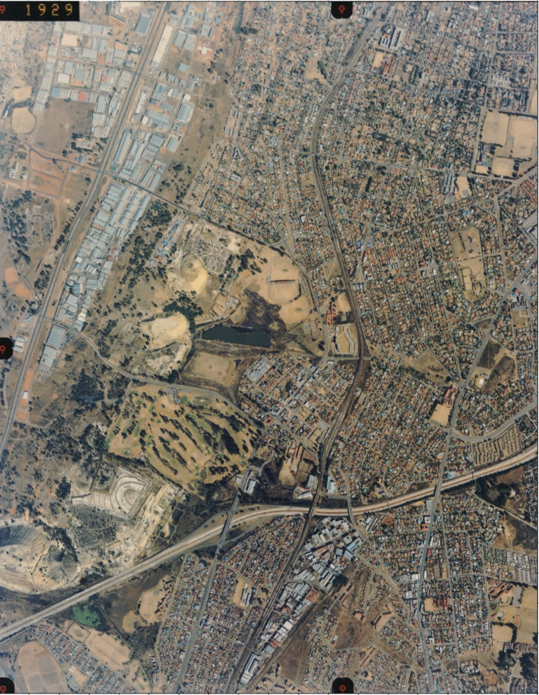
The aerial photograph below shows an urban area taken at 13:03 (1:03 PM). Notice how the shadows of buildings help identify their height and shape, while also indicating the sun's position at the time the photograph was taken.
The three elements working together
These three elements don't work in isolation - they complement each other to provide a complete picture of the landscape.
The diagram shows how tone/colour, texture, and shadows/height work together with pattern to create what geographers call "increasing complexity" in photograph interpretation. The more elements you can identify and analyse together, the more accurate your interpretation becomes.
Practical applications
Step-by-Step Photo Interpretation Method:
When examining aerial photographs or orthophoto maps, always consider all three elements:
- Start with tone - What's light and what's dark?
- Examine texture - What appears smooth versus rough?
- Study shadows - What do they tell you about height, shape, and direction?
- Combine your observations - Use all three elements together for accurate identification
This systematic approach will help you successfully identify features like residential areas, commercial districts, agricultural lands, water bodies, and natural vegetation.
Key Points to Remember:
- Tone shows lightness and darkness - use it to distinguish between different materials and features
- Texture reveals surface characteristics - smooth for urban areas, rough for natural features
- Shadows provide height information and help determine direction - essential for orientation
- Cold tones are bluish, warm tones are reddish in colour photographs
- Always combine all three elements for the most accurate photograph interpretation
- Shadow direction helps you find north - crucial for proper map orientation