Mapwork Skills (Grade 11 NSC Matric Geography): Revision Notes
Locating Exact Position
Finding the exact location of any place on Earth is a fundamental skill in geography. This process involves understanding coordinate systems, modern technology like GPS, and traditional map-reading techniques.
Understanding Earth's coordinate system
Earth uses a grid system made up of imaginary lines to pinpoint any location precisely. This system consists of two types of lines that work together to create a global address system.
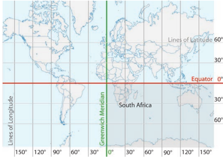
Lines of latitude (parallels) run horizontally around Earth, parallel to each other. These lines form concentric circles around the globe and are measured as the angular distance north and south from the equatorial horizontal plane. The equator sits at 0° latitude, with lines extending to 90° North and 90° South at the poles.
Lines of longitude (meridians) run vertically from the North Pole to the South Pole. Unlike latitude lines, meridians intersect at both poles. They are measured as the angular distance east and west from the Greenwich Meridian (0° longitude), extending to 180° East and 180° West.
The point where a parallel and meridian intersect is called a co-ordinate or grid reference. This intersection creates a unique address for every location on Earth, similar to how street addresses work in cities.
For example, South Africa is located south of the equator and east of the Greenwich Meridian, giving it a position that can be precisely defined using these coordinates.
Global Positioning System (GPS)
Modern technology has revolutionised how we determine exact positions. A Global Positioning System (GPS) provides precise location data by using satellite technology.
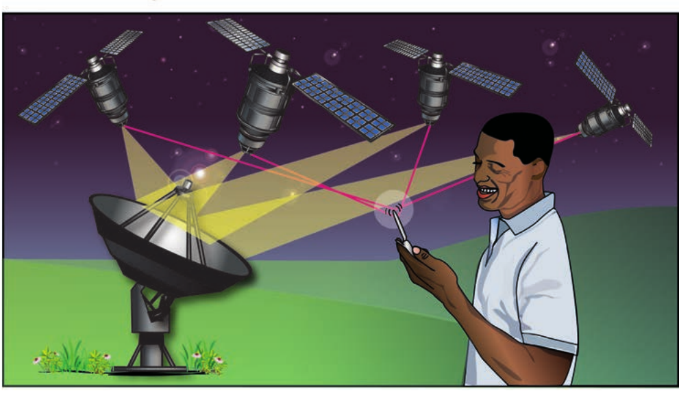
How GPS Works Through Triangulation
GPS works through triangulation - a process that calculates your exact position by measuring distances from three or more satellites orbiting Earth. Each satellite continuously broadcasts its location and the time. Your GPS device receives these signals and calculates how long each signal took to reach you, determining your distance from each satellite. With at least three satellites, the system can pinpoint your exact location.
This technology benefits many users:
- General public for navigation and location services
- Land surveyors for precise measurements
- Emergency services for rapid response
- Scientists for research and data collection
Reading coordinates on topographic maps
When working with topographic maps, you need to understand how coordinates are expressed and read. Coordinates are given in a specific order and format that provides precise location information.
Coordinate format and reading
Exact positions are expressed as co-ordinates showing both latitude and longitude in that specific order. Each coordinate includes:
- Degrees (°) - the largest unit of measurement
- Minutes (') - there are 60 minutes in 1 degree
- Seconds (") - there are 60 seconds in 1 minute
Worked Example: Reading Coordinate Format
For the coordinate: 29°53'35"S; 31°02'50"E
This means:
- 29 degrees, 53 minutes, 35 seconds South latitude
- 31 degrees, 2 minutes, 50 seconds East longitude
Remember: Latitude is always given first, followed by longitude.
Reading coordinates from maps
When reading coordinates from a topographic map:
- Latitude reference appears on the side margins of the map (northward/southward)
- Longitude reference appears across the top or bottom of the map (eastward)
- The latitude is always given first, followed by longitude
- This same system applies to atlas maps
Determining seconds accurately
For precise positioning, you may need to estimate coordinates to the nearest second. This requires subdividing the minute blocks on your map.
Practical method for determining seconds
Method for Determining Seconds to the Nearest Five
To find coordinates to the nearest second:
- Divide each minute block into halves, then into thirds, creating sections of ten seconds each
- You can subdivide further into five-second increments for greater accuracy
- Estimate the exact location to the closest multiple of five seconds
- This level of precision is sufficient for most practical applications

This technique allows you to determine positions with remarkable accuracy, essential for professional surveying, navigation, and geographic research.
Case study: TrigNet South Africa
South Africa provides an excellent example of how modern positioning technology works in practice through its TrigNet system.
Background and development
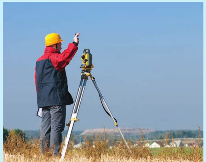
Until recently, South African surveyors relied on approximately 29,000 trigonometrical beacons positioned on mountains, hilltops, and prominent structures across the country. Surveyors used theodolites - precision instruments for measuring angles - to calculate exact positions by referencing these known beacon locations.
The introduction of GPS technology transformed this process. Geomatic engineering - the discipline of gathering, storing, processing, and delivering geographic information - now uses TrigNet as its primary tool.
How TrigNet operates
TrigNet System Overview
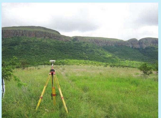
TrigNet was established in 1998 as a network of permanent, continuously operating GNSS (Global Navigation Satellite Systems) base stations. These stations are distributed throughout South Africa at approximately 100 to 300 kilometre intervals.
The system uses GPS technology as its primary positioning tool, allowing surveyors to achieve 5-centimetre accuracy in position measurements.
The system uses GPS technology as its primary positioning tool, allowing surveyors to:
- Link to a TrigNet station for reference
- Achieve 5-centimetre accuracy in position measurements
- Work more efficiently than traditional trigonometric methods
- Access standardised, reliable positioning data
Applications and benefits
TrigNet serves multiple purposes:
- Surveyors and geomatic engineers - precise land measurement and mapping
- GIS users - accurate geographic information systems data
- Atmospheric scientists and meteorologists - weather monitoring and research
- Geophysics research - studying Earth's physical properties
- Navigation systems - supporting transport and logistics
- Plate motion monitoring - tracking geological movements
- Space weather monitoring - ionosphere research
Technical Standards
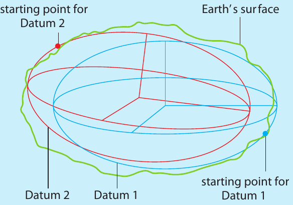
The system uses the Hartebeesthoek 94 Datum and World Geodetic System 1984 (WGS84) as its reference framework, ensuring compatibility with international standards and enabling accurate data exchange between different users and systems.
Key Points to Remember:
- Lines of latitude (parallels) run horizontally around Earth, while lines of longitude (meridians) run vertically from pole to pole
- GPS works through triangulation using three or more satellites to calculate exact position
- Coordinates are always written in order: latitude first, then longitude using degrees, minutes, and seconds
- There are 60 minutes in 1 degree and 60 seconds in 1 minute - remember this conversion for accurate calculations
- TrigNet represents modern surveying technology that combines GPS with permanent base stations for centimetre-level accuracy in South Africa