Intervisibility (Grade 11 NSC Matric Geography): Revision Notes
Intervisibility
What is intervisibility?
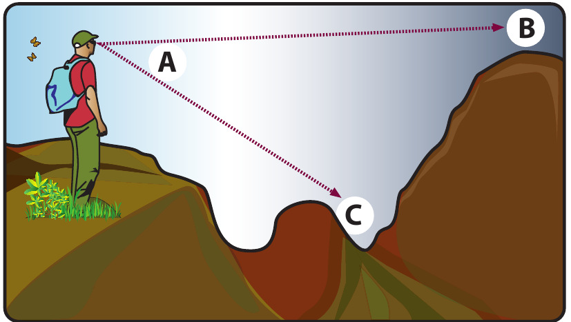
Intervisibility refers to being able to see between two locations on the landscape. When you stand at one point and can clearly see another specific location, those two points have good intervisibility. Think of it as having a clear line of sight between two places without any obstructions blocking your view.
This concept is particularly important in geography because it helps us understand how the physical landscape affects what we can observe from different positions. The terrain, including hills, valleys, and other physical features, plays a crucial role in determining whether two points are intervisible.
The concept of intervisibility is fundamental to understanding landscape visibility and has practical applications in many fields, from military strategy to modern telecommunications planning.
How to determine intervisibility
To work out whether two points are intervisible, geographers use a simple but effective method involving cross-sections. Here's how it works:
Worked Example: Testing Intervisibility Between Two Points
Step 1: Draw a line between the two points you want to test for intervisibility
Step 2: Create a cross-section showing the terrain profile along this line
Step 3: Check if the line passes through any physical features such as hills, ridges, or other elevated terrain
Step 4: If the line crosses through elevated land, then the points are not intervisible
Step 5: If the line remains clear without crossing obstacles, then the points are intervisible
This method helps us understand why some locations have excellent views whilst others are blocked by the surrounding landscape.
Understanding viewsheds
A viewshed is the area that you can see from a particular observation point. Imagine standing on a hill and looking around you - everything you can see from that position forms your viewshed. This concept is closely linked to intervisibility because it helps us map out all the areas that are visible from a specific location.
Calculating viewsheds has become much easier with modern technology, particularly Geographic Information Systems (GIS), which can create detailed maps showing exactly what areas are visible from any given point.
Practical applications of intervisibility
Understanding intervisibility has many real-world uses that affect our daily lives:
Military and security applications:
- Determining fields of fire and strategic positions
- Positioning border patrol cameras for maximum coverage
- Placing infrared sensors effectively
- Ensuring GPS signal availability in different locations
Planning for scenic beauty:
- Creating scenic viewpoints for tourists
- Designing parkway routes with beautiful vistas
- Protecting important landscape views from development
Infrastructure planning:
- Positioning cell phone towers for optimal coverage
- Planning solar panel installations for maximum sunlight
- Locating wind turbines effectively
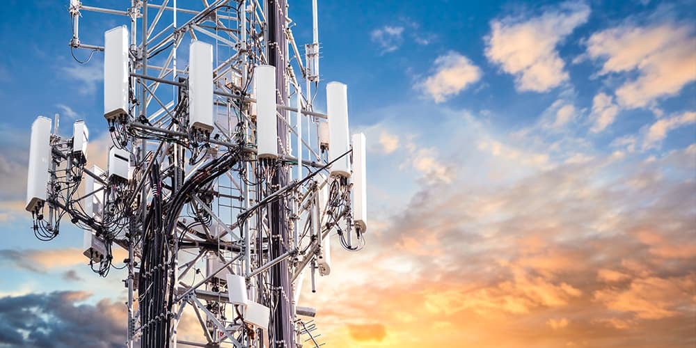
Case study: positioning cell phone towers
One of the most important applications of intervisibility is in telecommunications planning. When companies install cell phone towers, they must ensure there are no gaps in coverage that would leave customers without signal.
Intervisibility calculations help engineers determine the best locations for cell phone towers. If they don't carefully consider the terrain, some areas might end up with poor reception because hills or other obstacles block the signal transmission.
Modern planners use GIS technology to create detailed maps showing coverage areas, often called viewshed maps. These maps display which areas will receive strong signals (shown in green on coverage maps) and which areas might have reception problems.
The process involves:
- Analysing the terrain between potential tower locations and areas needing coverage
- Using computer models to predict signal strength
- Identifying areas where additional towers might be needed
- Optimising tower placement to minimise coverage gaps whilst reducing costs
This careful planning ensures that mobile networks provide reliable service across different types of terrain, from flat urban areas to hilly rural regions.
Key Points to Remember:
-
Intervisibility means being able to see between two points on the landscape without obstructions
-
Use cross-sections to determine intervisibility - if the line between points crosses through elevated terrain, they are not intervisible
-
A viewshed is all the area you can see from one specific observation point
-
Practical applications include military planning, tourism development, and infrastructure placement like cell phone towers
-
GIS technology makes it much easier to calculate viewsheds and plan optimal locations for various purposes