Examples of Fieldwork Titles/Questions (AQA A-Level Geography): Revision Notes
Examples of Fieldwork Titles/Questions
Why your fieldwork choice matters
Selecting an appropriate fieldwork investigation is one of the most important decisions you'll make during your A-Level Geography course. Your fieldwork accounts for 20% of your final assessment, so choosing a topic that genuinely interests you is essential. Beyond the marks, fieldwork requires a significant time commitment, so you'll want to investigate something that keeps you engaged throughout the process.
When choosing your fieldwork topic, consider practical constraints. If you live in south-east England, for example, studying glacial processes may prove difficult. Similarly, certain aspects of the specification naturally lend themselves to fieldwork investigation more easily than others. The key is to align your interests with what's practically achievable in your local area.
Understanding fieldwork possibilities
The following sections present fieldwork suggestions across different geographical themes. These examples are not exhaustive but provide a starting point that you can adapt to suit your specific location and circumstances. Each suggestion can be modified to create a unique investigation relevant to your area.
The fieldwork examples provided across all themes are designed to be flexible. You should adapt these suggestions to match your local geographical context, available resources, and personal interests. Consider how each example could be modified to investigate similar processes or patterns in your area.
Water and carbon cycles
This theme focuses on how human activities interact with natural water and carbon systems. You might investigate:
- How human activities have changed the runoff patterns of a river system, such as the River Harbourne in south Devon
- The environmental consequences of draining peatland areas and burning moorland vegetation, particularly examining the connection to recent flooding events in towns like Hebden Bridge, West Yorkshire
- The potential for storing carbon in woodland areas, assessing sites like the Sankey Valley in the Mersey Forest region
These investigations allow you to examine human-environment interactions and environmental management strategies in your local area.
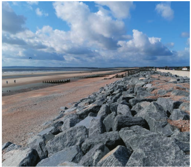
Coastal systems and landscapes
Coastal fieldwork offers excellent opportunities to study dynamic physical processes and management approaches. Consider investigating:
- The effectiveness of coastal protection structures at specific locations, such as the defences at Broomhill Sands in Kent
- How longshore drift processes have influenced the formation of coastal features like Dawlish Warren sand spit in Devon
- The role of underlying rock types (geology) in shaping coastal landscapes, such as those found in south-west Anglesey
- Changes in biodiversity across coastal sand dune systems, measuring from the high-water mark to the dune heath
Coastal environments provide clear visual evidence of processes and are often easily accessible for data collection.
Glacial systems and landscapes
If you have access to upland or formerly glaciated areas, these investigations can reveal evidence of past ice age processes:
- Examining how glacial erosion has dominated the landscape formation in areas like Great Langdale, Cumbria
- Investigating the contribution of fluvioglaciation (meltwater processes) to landform development in locations such as the Fylde peninsula in Lancashire
- Assessing evidence that indicates features like the Bradford Kaims in Northumberland are eskers (glacial meltwater deposits)
Glacial landscapes provide tangible evidence of processes that occurred thousands of years ago during the last ice age. Even if you don't live near mountains, many lowland areas in the UK show evidence of past glaciation through features like eskers, moraines, and glacial deposits.
These studies connect current landscape features to past geological events.
Ecosystems under stress
Ecosystem fieldwork examines the relationship between human activities and biodiversity:
- How different agricultural land uses affect the variety of species in locations across north Northumberland
- The impact of local environmental factors on the ecological development of specific sites like Wistman's Wood on Dartmoor, Devon
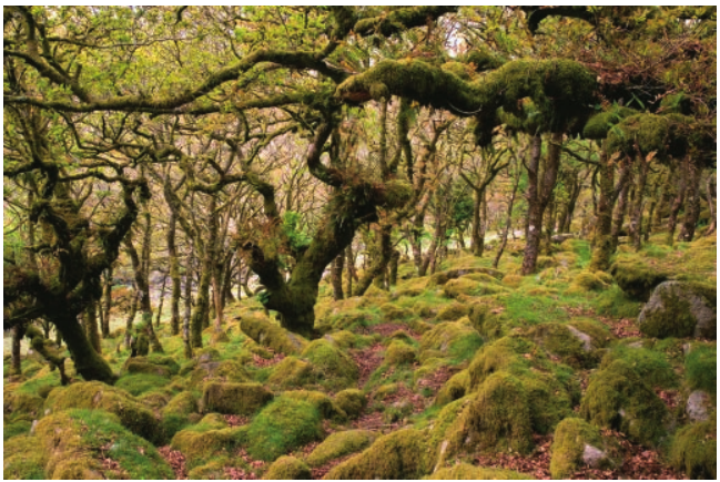
This ancient woodland provides an excellent case study for examining how local conditions create unique ecological communities.
Worked Example: Biodiversity Assessment in Agricultural Landscapes
Step 1: Select multiple sites with different agricultural land uses (e.g., intensive arable, pasture, organic farming)
Step 2: Use quadrat sampling to measure plant species diversity at each site
Step 3: Record environmental variables (soil pH, moisture, light levels)
Step 4: Compare biodiversity indices between different land use types
Step 5: Analyze whether more intensive agricultural practices correlate with lower species diversity
Global systems and global governance
This theme explores how global economic systems function at the local level:
- Determining whether major supermarket chains in locations like Taunton, Somerset rely on international supply networks to provide year-round fresh produce variety
- Assessing how large retail chains (such as TNC retail operations) affect the retail character of central Dorchester
- Investigating the reliance on migrant labour in agricultural regions like the Breckland area of Norfolk
These investigations connect global economic processes to observable local impacts.
Changing places
Fieldwork on changing places examines how locations develop distinct characteristics and how people perceive them:
- Comparing how visitors perceive Blackpool differently from how it is represented in various media sources
- Finding evidence of gentrification processes in areas like Hebden Bridge, West Yorkshire
- Examining how the physical landscape (topography and geography) has contributed to the distinctive character of places like Totnes in Devon
When investigating changing places, it's crucial to gather perspectives from multiple stakeholder groups. Different people may perceive the same location very differently based on their experiences, age, background, and relationship with the place. This diversity of views is valuable data for your investigation.
Contemporary urban environments
Urban fieldwork investigates how cities function and develop:
- Measuring how urban development patterns affect the local climate in places like Croydon
- Evaluating whether Sustainable Urban Drainage Systems (SUDS) in developments like Grovelands Park Wetlands in London successfully manage water
- Determining if specific areas, such as the Jewellery Quarter, can be considered unique urban landscapes within the broader context of central Birmingham
Urban investigations often benefit from good public transport access and availability of secondary data sources.
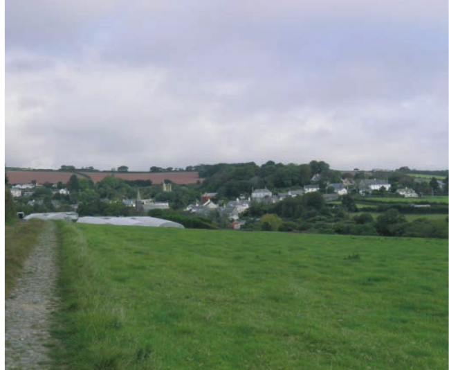
Population and the environment
This theme examines human-environment relationships at different scales:
- Investigating the connection between soil characteristics and land use patterns in locations like the Vale of Pickering, exemplified by the parish of Snainton in North Yorkshire
- Assessing whether villages like Slapton in south Devon show characteristics of settlement decline
These investigations often combine physical geography factors with human geography outcomes.
Resource security
Resource security fieldwork examines energy production and resource use:
- Assessing both the practicality and potential impacts of a proposed wind farm development on Bosley Minn, Cheshire
- Investigating the historical and ongoing effects of coal mining on towns like Amble in Northumberland
- Examining how the development of renewable energy facilities, such as Lathom Solar Farm in West Lancashire, has affected both the local community and physical landscape
Resource security investigations often involve examining both environmental impacts and community perspectives. Consider how energy developments affect not just the physical landscape, but also local employment, community identity, and attitudes towards renewable energy.
Practical considerations for an urban development case study
When investigating new housing developments, you can employ several primary data collection approaches:
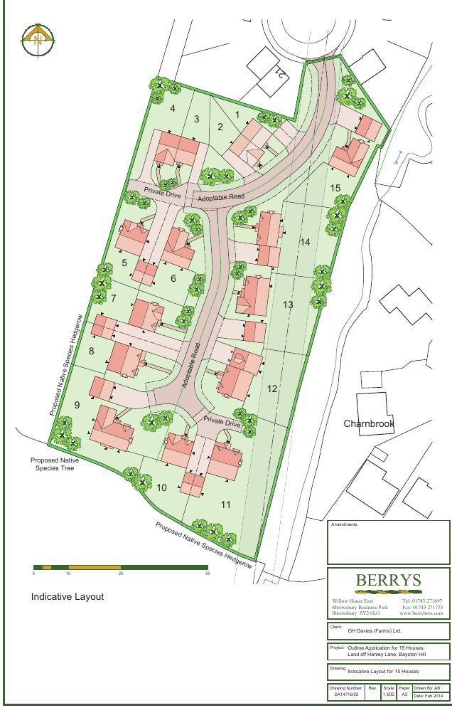
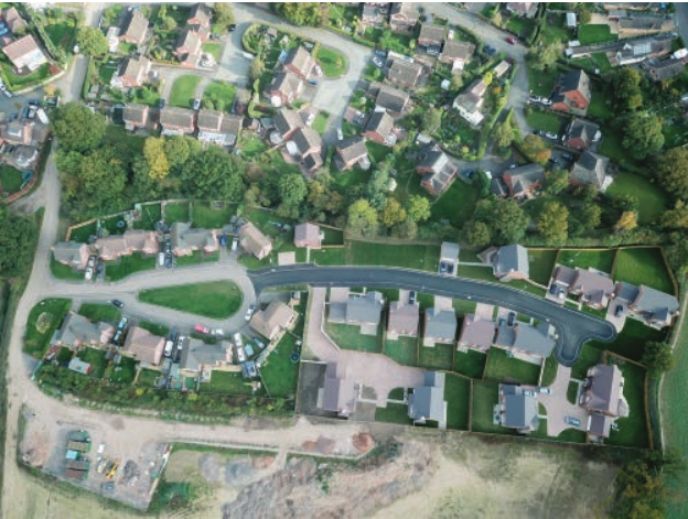
- Conducting surveys with various stakeholders including landowners, developers, planning officers, local councillors, and residents of nearby estates
- Distributing questionnaires to understand attitudes towards proposed changes, using an age-related stratified sample to ensure representative views from different demographic groups
- Performing traffic surveys to assess concerns about site access for both developers and future residents
Worked Example: Questionnaire Design for Housing Development
Step 1: Identify key themes (traffic concerns, environmental impact, community facilities, housing need)
Step 2: Design questions using a mix of scales (e.g., 1-5 rating for impact severity) and open responses
Step 3: Calculate required sample size based on local population (aim for representative sample of at least 30 respondents per age group)
Step 4: Use stratified sampling to ensure proportional representation across age groups
Step 5: Code qualitative responses by identifying recurring themes and patterns
Interview responses can be coded based on themes that emerge, while questionnaire data can be summarized in tables with appropriate graphs. Your analysis approach will depend on what patterns and relationships you discover in your data.
Key Points to Remember:
- Fieldwork carries significant weight: Your investigation represents 20% of your final course assessment, so invest time in selecting an appropriate topic
- Choose what interests you: You'll spend considerable time on this investigation, so select something that genuinely engages your curiosity
- Consider practical constraints: Your local geography and available resources will influence what's feasible to investigate
- Be flexible with locations: The examples provided are guides that can be adapted to suit your specific area and circumstances
- Link to specification content: Ensure your chosen investigation connects clearly to the geographical concepts you're studying in class
- Collect diverse perspectives: Include multiple stakeholder views in your primary data collection
- Plan your data collection carefully: Use appropriate sampling methods and ensure your sample size is sufficient for meaningful analysis