Tectonic Plate Activity (Leaving Cert CASD): Revision Notes
Tectonic Plate Activity
What is plate tectonics?
Plate tectonics is a fundamental scientific theory that explains how Earth's major landforms are created through the movement of massive geological plates beneath our feet. This theory revolutionised our understanding of Earth by showing how moving plates are responsible for creating mountains, volcanic activity, and earthquakes - all of which have significant impacts on climate patterns.
The theory demonstrates how Earth's geological processes directly influence climate by creating features like mountain ranges that affect wind patterns, volcanic activity that can alter atmospheric composition, and changes in ocean basin configuration that impact ocean currents.
The connection between geological processes and climate systems shows how Earth operates as an integrated system, where changes in one component can have far-reaching effects on others.
Earth's structure and plate movement
Earth's outermost layer, called the lithosphere, consists of the crust and upper mantle broken into large rocky sections called tectonic plates. These plates sit on top of a partially molten layer of rock known as the asthenosphere.
Due to convection currents in the asthenosphere and lithosphere, these massive plates move relative to each other at remarkably slow but constant rates - typically between 2 to 15 centimetres per year. This movement may seem insignificant, but over millions of years, it creates dramatic changes to Earth's surface that profoundly affect climate.
Understanding Geological Time Scales
While 2-15 cm per year seems incredibly slow, consider that over just 10 million years, plates can move 200-1,500 kilometres - enough distance to completely reshape continents and ocean basins!
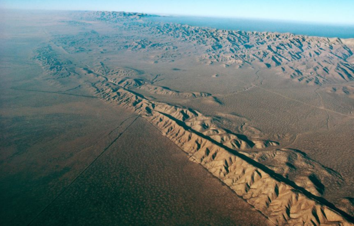
The interaction between tectonic plates is responsible for forming major geological features such as the Himalayan mountain range in Asia, the East African Rift, and the San Andreas Fault in California, United States.
Development of plate tectonic theory
Wegener's continental drift hypothesis
The foundation for plate tectonic theory began in 1912 when German scientist Alfred Wegener proposed the concept of continental drift. He suggested that 200 million years ago, a massive supercontinent called Pangaea began breaking apart, with its pieces gradually moving to form the continents we see today.
Evidence for Continental Drift
Wegener supported his theory with compelling evidence including:
-
Matching rock formations found in Brazil and West Africa
-
Similar fossils discovered on opposite sides of the Atlantic Ocean
-
The jigsaw-puzzle fit of South America and Africa's coastlines
-
Identical mountain ranges that appeared to continue across ocean basins
Despite compelling evidence, Wegener's ideas were initially dismissed by the scientific community because he couldn't explain the mechanism that would cause continents to move. The missing piece was understanding the role of seafloor spreading and convection currents.
Evidence for seafloor spreading
The theory gained credibility in the 1950s and 1960s when new oceanic research provided crucial supporting evidence. Maps of the ocean floor revealed massive underwater mountain ranges that almost encircled the entire Earth.
American geologist Harry Hess proposed that these ridges resulted from molten rock rising from the asthenosphere. As this rock reached the surface, it cooled and formed new oceanic crust, gradually pushing the seafloor away from the ridge in a conveyor-belt motion. Millions of years later, this crust would disappear into ocean trenches at locations called subduction zones, cycling back into Earth's interior.
Magnetic data from the ocean floor and the relatively young age of oceanic crust provided strong support for this seafloor spreading hypothesis.
Hot spots and volcanic island chains
One puzzling question remained: most volcanoes occur above subduction zones, but some form far from plate boundaries. Canadian geologist John Tuzo Wilson solved this mystery in 1963 by proposing that volcanic island chains, such as the Hawaiian Islands, are created by fixed hot spots in the mantle.
At these locations, magma forces its way upward through the moving plate above. As the plate continues moving over the stationary hot spot, a chain of volcanic islands forms one after another. Wilson's explanation provided the final piece of evidence that made plate tectonic theory almost universally accepted today.
Climate connections
Tectonic plate activity serves as a major natural factor influencing climate through several mechanisms:
Mountain building: When plates collide, they create mountain ranges that dramatically alter wind patterns, precipitation distribution, and regional temperature variations. Mountains act as barriers to air masses, creating rain shadows and influencing monsoon patterns.
Volcanic activity: Volcanic eruptions associated with plate boundaries can inject massive amounts of ash and gases into the atmosphere, potentially cooling global temperatures for months or years. Long-term volcanic activity can also release carbon dioxide, contributing to greenhouse warming.
Ocean basin configuration: As plates move, they change the size and shape of ocean basins, affecting ocean currents that transport heat around the globe. The opening and closing of ocean gateways between continents can dramatically alter global climate patterns.
Continental positioning: The movement of continents to different latitudes affects their climate zones and influences global atmospheric circulation patterns.
Key Points to Remember:
-
Plate tectonics explains major landform creation - The movement of Earth's lithospheric plates creates mountains, volcanoes, and fault systems that significantly influence regional and global climate patterns.
-
Plates move on the asthenosphere - Earth's rocky plates sit on a partially molten layer and move at rates of 2-15 centimetres per year due to convection currents.
-
The theory developed over time - From Wegener's continental drift (1912) to seafloor spreading evidence (1950s-60s) to Wilson's hot spots (1963), multiple discoveries built our modern understanding.
-
Tectonic activity affects climate in multiple ways - Through mountain building that alters wind patterns, volcanic activity that changes atmospheric composition, and continental positioning that influences ocean currents and global circulation.
-
Examples include major geological features - The Himalayas, San Andreas Fault, Hawaiian Islands, and East African Rift all demonstrate how tectonic processes shape Earth's surface and climate systems.