Water (AQA A-Level Geography): Revision Notes
Water
Introduction to water in hot desert systems
Water plays a crucial role as a primary input in hot desert environments, acting as a significant agent of landscape change. Despite the arid conditions, water drives various erosional and depositional processes that actively shape desert landscapes. Additionally, water is responsible for transporting substantial amounts of sediment, making it a key factor in material movement across these environments.
Whilst rainfall and surface water are scarce in hot desert regions, several water sources exist. Rivers may originate from outside the desert boundaries or from elevated areas. Along with occasional intense rainfall events and sudden heavy downpours, these water sources can produce enough flow to significantly impact the landscape.
In mountainous desert areas and high plateaux, water primarily acts as an erosive force, whilst in flatter lowland regions, depositional landforms become more prevalent. This contrast reflects differences in water energy and transport capacity across different topographies.
Sources of water
Exogenous rivers
Exogenous rivers are watercourses that begin outside desert boundaries in adjacent highland regions and more humid environments. They flow from external areas and pass through the desert.
These rivers are notable because their flow volume is substantial enough to maintain year-round (perennial) flow, though they often respond to seasonal rainfall or snowmelt patterns in their source regions. Exogenous rivers, sometimes called exotic sources due to their external origin, along with associated groundwater and rivers, represent the largest volume of water flowing through hot desert environments.
A prime example is the River Nile, which begins its journey in the Ethiopian highlands and central African regions before flowing northward through the arid landscapes of North Africa, ultimately reaching the Mediterranean Sea at the Nile Delta.
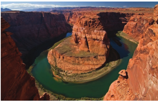
Another significant example is the Colorado River. This river originates in the Rocky Mountains and travels across the arid regions of southwest USA before reaching the Pacific Ocean. These exogenous rivers have been historically vital to human populations in the regions they traverse, providing reliable and consistent water flow.
Endoreic systems
Endoreic rivers are watercourses that occupy closed drainage basins. Rather than flowing to the sea or other rivers, they end inland in lakes or swamps.
Examples of endoreic systems include the River Jordan, which flows into the Dead Sea, and the Okavango River. The Okavango flows into Botswana where it divides into multiple channels called distributaries to form the Okavango Delta.
Ephemeral rivers
Ephemeral rivers are watercourses that flow on the surface only periodically, typically appearing after heavy rainstorms.
These rivers are commonly found in hot desert areas and flow intermittently. Following intense rainfall events, the sudden nature and intensity of the precipitation can generate enormous volumes of overland flow. This leads to substantial increases in channel discharge, occurring very rapidly with extremely short lag times (the delay between peak rainfall and peak river discharge).
Several factors contribute to these short lag times:
- The magnitude of the precipitation event itself
- Minimal vegetation means limited interception of rainfall
- Extended drought periods and removal of loose surface material by wind action result in a baked, hardened desert surface, which significantly reduces the land's infiltration capacity (ability to absorb water)
The episodic nature of rainfall
Rainfall variability in subtropical deserts
The sporadic nature of rainfall in hot desert regions is particularly evident in North Africa. Subtropical deserts such as the Sahara experience arid conditions for most of the year due to persistent high-pressure systems. These conditions produce average annual rainfall of approximately 25 mm, generally reaching only 100 mm in the high plateaux regions of Ahaggar and Tibesti. Certain parts of western Algeria and southwest Egypt can experience periods of two to five years without receiving more than 0.1 mm of rain in any 24-hour period.
However, individual rainfall events can deliver two to three times the annual average during brief but intense desert storms.
Intense Desert Rainfall: Algeria
Some west-facing slopes in parts of Algeria have recorded remarkable rainfall intensities:
- 8.7 mm falling in just 3 minutes
- 46 mm in slightly over one hour
These extreme events demonstrate how concentrated desert rainfall can be, delivering months' worth of precipitation in minutes.
Much of this rainfall variability occurs in the Sahara during summer months. The West African Monsoon shifts northward towards the region and can occasionally push areas of moist south-westerly air further north into the desert itself. This creates short-lived areas of low pressure.
Thunderstorm development
Disruption of the subtropical high-pressure cells along the belt can also create troughs or gaps in the high-pressure system at the surface. This allows more moist air to move northward, creating low-pressure areas and bringing rainfall to the southern margins of the Sahara.
In desert areas where local water sources exist to provide atmospheric moisture, intense heating of the desert surface can cause localised atmospheric warming. This creates localised rising air and low-pressure systems. When combined with such intense heating and rapid rising and cooling of air, substantial releases of latent heat during condensation can drive uplift, generating large but short-lived thunderstorms.
Water-driven processes and landforms
Sheet flooding
During intense torrential downpours, both the impermeability of some desert surfaces and the sheer speed and volume of rainfall can trigger sheet floods. Initially, rain impact begins to dislodge and mobilise loose material across the surface (a process called sheet wash or sheet erosion).
As water volume increases, this overland flow intensifies. It can rapidly develop into extensive but relatively shallow floods. These substantial volumes of overland flow are capable of removing large amounts of material through sheet erosion. This creates erosional features whilst simultaneously contributing to depositional features downstream.
Sheet flooding is particularly effective on impermeable desert surfaces where water cannot easily infiltrate. The broad, shallow nature of these floods means they can affect large areas simultaneously, making them a significant geomorphological process in desert environments.
Channel flash flooding
When overland flow becomes funnelled into steep-sided narrow valleys, termed wadis (or arroyos in the Americas), channel flash flooding occurs. These events can transport significant sediment loads and can be extremely powerful. The concentration of water in such narrow valleys creates deep, fast-flowing torrents of water with enormous potential for both erosion and sediment transport. Consequently, when the flow subsides, significant depositional features are left behind.
Key Points to Remember:
- Water is a crucial driver of change in hot deserts despite limited availability, causing significant erosion, deposition and sediment transport
- Three main water sources exist: exogenous rivers (originating externally with perennial flow), endoreic rivers (ending in closed basins), and ephemeral rivers (flowing periodically after rain)
- Rainfall in hot deserts is highly episodic - the Sahara can go years without rain, but individual storms can deliver 2-3 times the annual average in short periods
- Sheet flooding occurs when torrential rain creates overland flow across impermeable surfaces, removing large volumes of material
- Channel flash flooding in wadis creates powerful, fast-flowing torrents with short lag times due to lack of vegetation and low infiltration capacity, producing significant erosional and depositional features