Plans and elevations (AQA GCSE Maths): Revision Notes
Plans and elevations
What are plans and elevations?
Plans and elevations are 2D drawings that show 3D shapes from different viewing directions. They help us understand and represent three-dimensional objects on flat surfaces like paper.
When architects design buildings or engineers create technical drawings, they use plans and elevations to show exactly what a structure looks like from every important angle.
This technique is essential in fields like architecture, engineering, and technical design where precise visual communication is crucial.
The three different views
There are three main types of views you need to know:
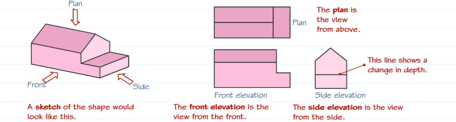
Plan view
The plan view is what you see when looking down at an object from directly above. Think of it like looking at a building plan or a bird's eye view. This view shows the shape's outline and how it extends horizontally.
Remember: Plan = from above, like a building plan or map view.
Front elevation
The front elevation shows what you see when looking straight at the front face of the object. This view reveals the height and width of the shape as seen from the front.
Side elevation
The side elevation displays what you see when looking at the object from the side. This view shows the height and depth of the shape from a sideways perspective.
How to draw plans and elevations
Drawing plans and elevations becomes easier when you use this visualisation technique:
Visualization Technique: The Transparent Box Method
Step 1: Imagine placing your 3D shape inside a transparent box Step 2: Picture yourself tracing the outline of the shape on each side of this box - the top, front, and side faces Step 3: When you unfold these traced outlines, you get your plan and elevation drawings
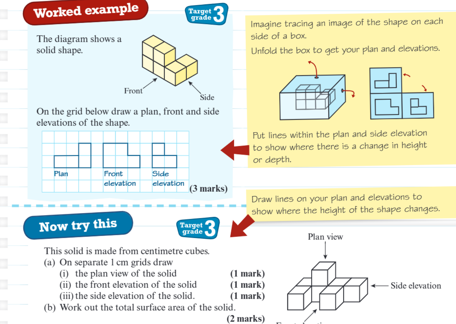
When you unfold these traced outlines, you get your plan and elevation drawings.
Important drawing tips:
- Draw lines within your plan and elevations to show where there are changes in height or depth
- These lines help viewers understand the shape's structure even in 2D
- Use a grid to keep your drawings accurate and proportional
- Label each view clearly (Plan, Front elevation, Side elevation)
Nets of 3D shapes
A net is a flat pattern that can be folded up to create a 3D shape. Think of unfolding a cardboard box completely flat - that flat pattern is the net of the box.
To determine if a pattern is a net of a specific 3D shape, imagine folding it up. If the edges meet properly to form the complete shape without gaps or overlaps, then it's a valid net.
Nets are closely related to plans and elevations because both concepts involve representing 3D objects in 2D formats.
Remember!
Key Points to Remember:
- Plans and elevations are 2D representations of 3D shapes from different viewing angles
- Plan view = looking from above, front elevation = looking from the front, side elevation = looking from the side
- Use the box visualisation technique - imagine tracing the shape on each side of a transparent box
- Draw lines to show changes in height or depth within your 2D drawings
- Nets are flat patterns that fold up to make 3D shapes - test them by imagining the folding process